Daun (Verbandsgemeinde)
Daun is a collective municipality (Verbandsgemeinde) in the Vulkaneifel district of Rhineland-Palatinate, Germany. The seat of the Daun Verbandsgemeinde is in the municipality of Daun.
Daun | |
|---|---|
 Coat of arms | |
Location of Daun within Vulkaneifel district 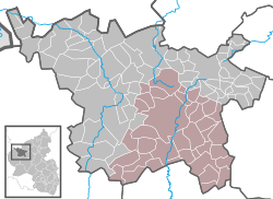 | |
 Daun  Daun | |
| Coordinates: 50°11′52″N 6°49′42″E | |
| Country | Germany |
| State | Rhineland-Palatinate |
| District | Vulkaneifel |
| Subdivisions | 38 municipalities |
| Government | |
| • Mayor | Werner Klöckner (CDU) |
| Area | |
| • Total | 31.589 km2 (12.197 sq mi) |
| Elevation | 494 m (1,621 ft) |
| Population (2018-12-31)[1] | |
| • Total | 22,664 |
| • Density | 720/km2 (1,900/sq mi) |
| Time zone | CET/CEST (UTC+1/+2) |
| Vehicle registration | DAU |
| Website | www.daun.de |
Constituent municipalities
- Betteldorf
- Bleckhausen
- Brockscheid
- Darscheid
- Daun
- Demerath
- Deudesfeld
- Dockweiler
- Dreis-Brück
- Ellscheid
- Gefell
- Gillenfeld
- Hinterweiler
- Hörscheid
- Immerath
- Kirchweiler
- Kradenbach
- Mehren
- Meisburg
- Mückeln
- Nerdlen
- Niederstadtfeld
- Oberstadtfeld
- Sarmersbach
- Saxler
- Schalkenmehren
- Schönbach
- Schutz
- Steineberg
- Steiningen
- Strohn
- Strotzbüsch
- Udler
- Üdersdorf
- Utzerath
- Wallenborn
- Weidenbach
- Winkel
gollark: Why do you have ominous helicopters™?
gollark: Interestingly, solar panels are actually about ten times as efficient as photosynthesis in plants is.
gollark: Someone has a report comparing efficiency by various metrics of biological systems versus human ones, which was apparently in my browser history still: https://docs.google.com/document/d/1HUtUBpRbNnnWBxiO2bz3LumEsQcaZioAPZDNcsWPnos/view
gollark: I'm glad I thought to make this. It's very helpful.
gollark: Graphically.
References
- "Bevölkerungsstand 2018 - Gemeindeebene". Statistisches Landesamt Rheinland-Pfalz (in German). 2019.
Verbandsgemeinden in Vulkaneifel | ||
|---|---|---|
Coat of arms | ||
| Authority control |
|
|---|
This article is issued from Wikipedia. The text is licensed under Creative Commons - Attribution - Sharealike. Additional terms may apply for the media files.