Daoli District
Daoli District (simplified Chinese: 道里区; traditional Chinese: 道里區; pinyin: Dàolǐ Qū) is one of nine districts of the prefecture-level city of Harbin, the capital of Heilongjiang Province, Northeast China, forming part of the city's urban core. It is located on the Songhua River. It borders the districts of Songbei to the north, Daowai to the northeast, Nangang to the east, and Shuangcheng to the south, as well as the prefecture-level city of Suihua to the northwest.
Daoli 道里区 | |
|---|---|
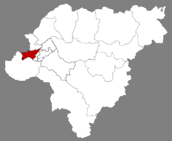 Location of Daoli in Harbin | |
.png) Harbin in Heilongjiang | |
| Coordinates: 45°45′20″N 126°37′00″E[1] | |
| Country | People's Republic of China |
| Province | Heilongjiang |
| Sub-provincial city | Harbin |
| Subdivisions | 20 subdistricts 3 towns |
| Area | |
| • Total | 479.2 km2 (185.0 sq mi) |
| Elevation | 130 m (430 ft) |
| Population (2010)[3] | |
| • Total | 923,762 |
| • Density | 1,900/km2 (5,000/sq mi) |
| Time zone | UTC+8 (China Standard) |
| Area code(s) | 0451 |
| Website | www |
Nowadays, Daoli District is also famous because of Central Street (中央大街; Zhōngyāng Dàjiē; Russian: Китайская улица), which is one of the main business streets in Harbin.
Administrative divisions
There are 20 subdistricts (街道) and three towns (镇) in the district:[4]
Subdistricts
|
|
Towns
- Xinfa (新发镇)
- Xinnong (新农镇)
- Yushu (榆树镇)
gollark: Macron has dependent types so it's fine.
gollark: NATIONAL SECURITY REASONS.
gollark: No it's not. America is in my basement nowadays.
gollark: What of those in America with bad tap water?
gollark: The halogens make it tingle pleasantly on my tongue.
References
- Google (2014-07-02). "Daoli Government" (Map). Google Maps. Google. Retrieved 2014-07-02.
- Harbin Statistical Yearbook 2011 (《哈尔滨统计年鉴2011》). Accessed 8 July 2014.
- 2010 Census Harbin primary statistics report (《哈尔滨市2010年第六次全国人口普查主要数据公报》). Accessed 8 July 2014.
- 2011年统计用区划代码和城乡划分代码:道里区 (in Chinese). National Bureau of Statistics of the People's Republic of China. Retrieved 2013-01-29.
This article is issued from Wikipedia. The text is licensed under Creative Commons - Attribution - Sharealike. Additional terms may apply for the media files.