Daocheng County
Daocheng County or Dapba in Tibetan (Tibetan: འདབ་པ་རྫོང་།, Wylie: ’dab pa rdzong, ZYPY: Dabba Zong ; simplified Chinese: 稻城县; traditional Chinese: 稻城縣; pinyin: Dàochéng Xiàn), historically Daoba (稻坝; 稻壩; Dàobà), is a county of western Sichuan Province, China, located in the eastern Hengduan Mountains. It is under the administration of the Garzê Tibetan Autonomous Prefecture with an overwhelmingly Tibetan population. Its latitude ranges from 27° 58' to 29° 30' N and longitude 99° 56' to 100° 36', and reaches 174 kilometres (108 mi) in north-south extent and 63 km (39 mi) in east-west width, with elevations ranging from 2,000 to 6,032 m (6,562 to 19,790 ft).
Daocheng County 稻城县 · འདབ་པ་རྫོང་། | |
|---|---|
County | |
 White Pagoda in Daocheng County | |
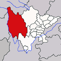
.png) Daocheng County (red) within Garzê Prefecture (yellow) and Sichuan | |
 Daocheng Location of the seat in Sichuan | |
| Coordinates (Daocheng government): 29°02′16″N 100°17′51″E | |
| Country | People's Republic of China |
| Province | Sichuan |
| Autonomous prefecture | Garzê |
| Township-level divisions | 3 towns 11 townships |
| County seat | Jinzhu |
| Area | |
| • Total | 7,323 km2 (2,827 sq mi) |
| Elevation | 3,753 m (12,313 ft) |
| Population (2010)[1] | |
| • Total | 31,113 |
| • Density | 4.2/km2 (11/sq mi) |
| Time zone | UTC+8 (China Standard) |
| Website | www |
History
The explorer Joseph Rock departed from Lijiang in 1928 and visited Daocheng.[2]
After the fall of Qing Dynasty, Xiangcheng and Daocheng fell into chaos. Daocheng was controlled by local chiefs (土头,; tǔtóu) centered in Daoba and the Kongkaling (贡噶岭,; Gònggálĭng) region from 1930s to 1950s.[3]
Administrative Divisions
Ten townships:
Climate
| Climate data for Daocheng (1981−2010) | |||||||||||||
|---|---|---|---|---|---|---|---|---|---|---|---|---|---|
| Month | Jan | Feb | Mar | Apr | May | Jun | Jul | Aug | Sep | Oct | Nov | Dec | Year |
| Record high °C (°F) | 18.7 (65.7) |
18.7 (65.7) |
23.5 (74.3) |
23.7 (74.7) |
25.2 (77.4) |
27.0 (80.6) |
27.9 (82.2) |
24.9 (76.8) |
23.8 (74.8) |
21.5 (70.7) |
19.0 (66.2) |
17.2 (63.0) |
27.9 (82.2) |
| Average high °C (°F) | 6.4 (43.5) |
7.5 (45.5) |
10.3 (50.5) |
13.5 (56.3) |
17.3 (63.1) |
19.5 (67.1) |
18.4 (65.1) |
17.8 (64.0) |
16.8 (62.2) |
14.4 (57.9) |
10.2 (50.4) |
7.3 (45.1) |
13.3 (55.9) |
| Daily mean °C (°F) | −4.5 (23.9) |
−2.4 (27.7) |
1.3 (34.3) |
5.0 (41.0) |
9.5 (49.1) |
12.4 (54.3) |
12.3 (54.1) |
11.5 (52.7) |
10.1 (50.2) |
6.0 (42.8) |
0.1 (32.2) |
−3.8 (25.2) |
4.8 (40.6) |
| Average low °C (°F) | −13.2 (8.2) |
−10.6 (12.9) |
−6.2 (20.8) |
−2.3 (27.9) |
2.2 (36.0) |
6.7 (44.1) |
8.0 (46.4) |
7.4 (45.3) |
5.5 (41.9) |
−0.4 (31.3) |
−7.2 (19.0) |
−12.1 (10.2) |
−1.8 (28.7) |
| Record low °C (°F) | −26.5 (−15.7) |
−23.6 (−10.5) |
−18.4 (−1.1) |
−10.4 (13.3) |
−6.7 (19.9) |
−1.7 (28.9) |
0.1 (32.2) |
−0.1 (31.8) |
−3.0 (26.6) |
−10.2 (13.6) |
−21.0 (−5.8) |
−27.6 (−17.7) |
−27.6 (−17.7) |
| Average precipitation mm (inches) | 0.8 (0.03) |
1.6 (0.06) |
6.9 (0.27) |
14.4 (0.57) |
33.8 (1.33) |
111.1 (4.37) |
194.8 (7.67) |
160.4 (6.31) |
101.1 (3.98) |
23.4 (0.92) |
5.0 (0.20) |
1.1 (0.04) |
654.4 (25.75) |
| Average relative humidity (%) | 37 | 39 | 44 | 49 | 52 | 63 | 75 | 76 | 73 | 62 | 50 | 41 | 55 |
| Source: China Meteorological Data Service Center | |||||||||||||
References
- 稻城县历史沿革 [Daocheng County Historical Development] (in Chinese). XZQH.org. 23 March 2015. Retrieved 25 November 2018.
1996年,稻城县面积7325.5平方千米,{...}2010年第六次人口普查,稻城县常住总人口31113人,其中:金珠镇7553人,香格里拉镇3031人,桑堆乡2580人,省母乡1712人,傍河乡1552人,色拉乡1785人,巨龙乡1957人,邓波乡980人,木拉乡1775人,赤土乡2665人,蒙自乡1961人,各卡乡806人,吉呷乡1442人,俄牙同乡1314人。
- "Archived copy". Archived from the original on 2014-04-10. Retrieved 2014-05-31.CS1 maint: archived copy as title (link)
- "乡城、稻城土头统治的由来及其嬗变" by 秦和平
- 行政区划 [Administrative Divisions] (in Chinese). Daocheng County People's Government. 12 July 2016. Retrieved 22 November 2018.
稻城县辖三个片区工委(稻坝工委、贡岭工委、东义工委)十四个乡镇(金珠镇、傍河乡、色拉乡、省母乡、桑堆镇、巨龙乡、邓坡乡、赤土乡、木拉乡、香格里拉镇、蒙自乡、各卡乡、吉呷镇、俄牙同乡 )。
- 2017年统计用区划代码和城乡划分代码:稻城县 [2017 Statistical Area Numbers and Rural-Urban Area Numbers: Daocheng County] (in Chinese). National Bureau of Statistics of the People's Republic of China. 2017. Retrieved 25 November 2018.
统计用区划代码 名称 513337100000 金珠镇 513337101000 香格里拉镇 513337102000 桑堆镇 513337201000 省母乡 513337202000 傍河乡 513337203000 色拉乡 513337204000 巨龙乡 513337205000 邓波乡 513337206000 木拉乡 513337207000 赤土乡 513337209000 蒙自乡 513337210000 各卡乡 513337211000 吉呷乡 513337212000 俄牙同乡

