Dahme, Brandenburg
Dahme (also: Dahme/Mark) is a town in the Teltow-Fläming district of Brandenburg, Germany. It is situated on the Dahme River, 30 km southeast of Luckenwalde, and 38 km west of Lübbenau.
Dahme | |
|---|---|
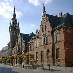 Town hall and post office | |
.png) Coat of arms | |
Location of Dahme within Teltow-Fläming district 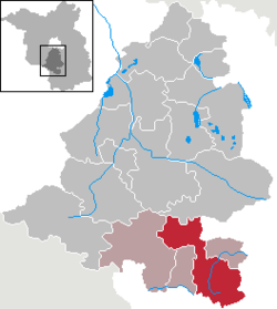 | |
 Dahme  Dahme | |
| Coordinates: 51°52′00″N 13°25′59″E | |
| Country | Germany |
| State | Brandenburg |
| District | Teltow-Fläming |
| Municipal assoc. | Dahme/Mark |
| Subdivisions | 13 Ortsteile |
| Government | |
| • Mayor | Thomas Willweber (FW) |
| Area | |
| • Total | 162.02 km2 (62.56 sq mi) |
| Elevation | 87 m (285 ft) |
| Population (2018-12-31)[1] | |
| • Total | 4,897 |
| • Density | 30/km2 (78/sq mi) |
| Time zone | CET/CEST (UTC+1/+2) |
| Postal codes | 15936 |
| Dialling codes | 035451 |
| Vehicle registration | TF |
| Website | www.dahme.de |
Demography
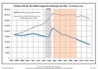 Development of Population since 1875 within the Current Boundaries (Blue Line: Population; Dotted Line: Comparison to Population Development of Brandenburg state. Grey Background: Time of Nazi rule; Red Background: Time of Communist rule.)
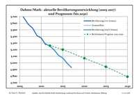 Recent Population Development (Blue Line) and Forecasts
|
|
|
Notable people
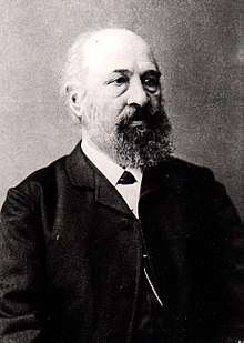
Hermann Hellriegel
- Karsten Greve (born 1946), an internationally renowned art dealer.
- Johannes Groenland (1824-1891), botanist and microscopist who worked for Vilmorin and was a professor of natural science in Dahme.
- Hermann Hellriegel (1831-1895), first head of the agricultural test station in Dahme from 1857 to 1873
- Max Jacob (1849-1921), architect
- Roswitha Krause (born 1949), swimmer and handball player
- Günther Marks (1897-1978), church musician and composer; lecturer for organ play and church music at the evangelical seminar in Dahme
- Otto Unverdorben (1806-1873), discoverer of the Aniline
- Birgit Vanderbeke (born 1956), writer
gollark: It's in hidden mode.
gollark: You can't, potatOS already infected your computer.
gollark: It is better now.
gollark: Yes.
gollark: This code is horrific.
References
- "Bevölkerung im Land Brandenburg nach amtsfreien Gemeinden, Ämtern und Gemeinden 31. Dezember 2018". Amt für Statistik Berlin-Brandenburg (in German). July 2019.
- Detailed data sources are to be found in the Wikimedia Commons.Population Projection Brandenburg at Wikimedia Commons
| Wikimedia Commons has media related to Dahme/Mark. |
Towns and municipalities in Teltow-Fläming | ||
|---|---|---|
Coat of arms of Teltow-Fläming district | ||
| Authority control |
|
|---|
This article is issued from Wikipedia. The text is licensed under Creative Commons - Attribution - Sharealike. Additional terms may apply for the media files.