Crugmeer
Crugmeer (Cornish: Krugmeur, great barrow) is a hamlet in north Cornwall, England, United Kingdom. It is situated one-and-a-half miles (2 kilometres) from Padstow to the west of the River Camel estuary.
Crugmeer
| |
|---|---|
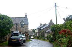 Looking east in Crugmeer, Cornwall | |
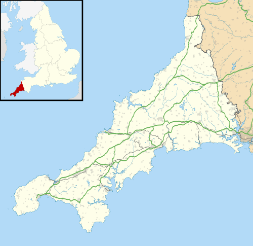 Crugmeer Location within Cornwall | |
| OS grid reference | SW901765 |
| Civil parish | |
| Unitary authority | |
| Ceremonial county | |
| Region | |
| Country | England |
| Sovereign state | United Kingdom |
| Post town | PADSTOW |
| Postcode district | PL28 |
| Dialling code | 01841 |
| Police | Devon and Cornwall |
| Fire | Cornwall |
| Ambulance | South Western |
| UK Parliament | |
The hamlet consists of half-a-dozen houses and a farm at the junction of two lanes. One lane gives access to Crugmeer from the Padstow-St Merryn road then continues northeast to Lellizzick, Hawker's Cove and Stepper Point. The other lane leads west from Crugmeer to Trevone beach.[1][2]
Crugmeer lies within the Cornwall Area of Outstanding Natural Beauty (AONB). Almost a third of Cornwall has AONB designation, with the same status and protection as a National Park.
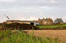
Looking west towards Crugmeer Farm
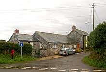
Crugmeer village centre, Cornwall, in 2008
External links
- The Crugmeer Society website Archived 2008-02-27 at the Wayback Machine
- Ordnance Survey: Landranger map sheet 200 Newquay & Bodmin ISBN 978-0-319-22938-5
![]()
Cornwall Portal | |
| Unitary authorities | |
| Major settlements |
|
| Rivers | |
| Topics | |
This article is issued from Wikipedia. The text is licensed under Creative Commons - Attribution - Sharealike. Additional terms may apply for the media files.