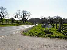
Crossmakelagher
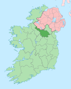
Crossmakelagher, also written Crossmakellagher or Crossmakellegher, (from Irish: Cros Mhic Chéileachair, meaning 'McKelleher's Crossroad; Locals abbreviate it as 'Cross') is a townland in the civil parish of Templeport, County Cavan, Ireland. It lies in the Roman Catholic parish of Templeport and barony of Tullyhaw.

Geography
Crossmakelagher is bounded on the north by Cavanaquill and Killynaff townlands, on the west by Tonyhallagh and Tonyrevan townlands, on the south by Bellaheady and Killarah townlands in Kildallan parish and on the east by Cormeen townland in Kildallan parish and Lecharrownahone townland. Its chief geographical features are the Shannon-Erne Waterway, a small plantation, a pond, a quarry, a spring well and several dug wells. Crossmakelagher is traversed by the regional R205 road, minor roads and rural lanes and the disused Cavan and Leitrim Railway. The townland covers 197 statute acres.[1]
History
Up until the 18th century it was divided into two different townlands, the part north of the present R205 main road was Crossmakelagher and the part between the R205 and the Shannon-Erne Waterway was called Drumcon (Irish derived place name|Druim Con, meaning 'The Ridge of the Greyhounds'). Crossmakelagher was also called Barne at the time (Irish derived place name Bearn, meaning 'A Gap').
The 1609 Baronial Map depicts the townland as Cross.[2][3]
The 1652 Commonwealth Survey spells the name as CrossmcKelagher and the other subdivisions as Barne and Drumgoone.
The 1665 Down Survey map depicts the north part as Crosmckellagher and the south part as Drumcone.[4]
William Petty's 1685 map depicts them as Crossemckelaher and Drumcon.[5]
In the Plantation of Ulster by grant dated 4 June 1611, along with other lands, King James VI and I granted one poll of Barne to Hugh McManus Oge Magauran.[6] He was the great-grandson of a previous Magauran chief, Tomás mac Maghnus Mág Samhradháin who ruled from 1512 to 1532. His father Manus Og lived in Cor and received a pardon in 1586.
In the Plantation of Ulster by grant dated 23 June 1610, along with other lands forming the Manor of Calva, King James VI and I granted two polls of Crosse to Hugh Culme.[7] In the same year Culme surrendered his interest to Walter Talbot of Ballyconnell. Walter Talbot died on 26 June 1625 at Ballyconnell and his son James Talbot succeeded to the Ballyconnell estate aged just 10 years. An Inquisition held in Cavan on 20 September 1630 found that James Talbot was seized of two polls of Crosse, along with other lands.[8] James Talbot married Helen Calvert, the daughter of George Calvert, 1st Baron Baltimore of Maryland, USA, in 1635. In the aftermath of the Irish Rebellion of 1641 James Talbot's estate was confiscated because he was a Catholic and he was granted an estate in 1655 at Castle Rubey, County Roscommon instead. He died in 1687. Talbot's land in Crossmakelagher was distributed as follows-
In the Hearth Money Rolls compiled on 29 September 1663[9] there were two Hearth Tax payers in Liosmackelagher- Cormucke McKelacher and Patricke McKelacher.
The 1652 Commonwealth Survey lists the townland as belonging to Captain Gwilliams (i.e. the landlord of Ballyconnell, Captain Thomas Gwyllym) and the tenants as Edward Rely & Others. The same survey also lists Barne and Drumgoone as belonging to Captain Gwilliams. A further confirming grant dated 11 August 1666 was made from King Charles II of England to Thomas Guyllym of Ballyconnell included 52 acres 1 rood and 24 perches in Crossmackillagher, alias Crosse, alias Barne and part of the same 10 acres and 16 perches. The grant also included 47 acres 2 roods in Dromcowen, alias Drumgoney.[10]
In the Irish Rebellion of 1641 Eleanor Reynolds of Lissanore made a deposition about the rebellion in Lissanover which included- Ellenor Reinolds of Late of Lissanore in the County of Cauan widow aged 46 yeares or thereabouts duly sworne etc. .. She further saith that in May 1642 this deponents mother not being able (because of age & weaknes) to goe to Croghan Castle was left behind with some of the tenants at Lissanore aforesaid, where she was about the tyme aforesaid barbarously murthered by one ffarell Groome mc Kellogher of CrossemacKellogher who confessed the said barbarous fact to divers persons that voluntarily did depose the same to be true.[11]
The 1790 Cavan Carvaghs list spells the name as Crossmakellagher.[12]
The Tithe Applotment Books for 1827 list twelve tithepayers in the townland.[13]
The Crossmakelagher Valuation Office Field books are available for 1839-1841.[14][15][16]
Griffith's Valuation of 1857 lists ten landholders in the townland.[17]
Census
| Year | Population | Males | Females | Total Houses | Uninhabited |
|---|---|---|---|---|---|
| 1841 | 34 | 19 | 15 | 8 | 0 |
| 1851 | 63 | 33 | 30 | 11 | 2 |
| 1861 | 49 | 25 | 24 | 11 | 1 |
| 1871 | 35 | 18 | 17 | 8 | 1 |
| 1881 | 31 | 18 | 13 | 7 | 1 |
| 1891 | 27 | 16 | 11 | 8 | 2 |
In the 1901 census of Ireland, there are eleven families listed in the townland[18] and in the 1911 census of Ireland, there are thirteen families listed in the townland.[19]
Antiquities
There seem to be no structures of historical interest in the townland apart from the disused Cavan and Leitrim Railway. In 1739 Dean John Richardson referred to two megaliths in Crossmaclaght but there is no trace today. He may have mistaken the location.[20]
References
- "IreAtlas". Retrieved 29 February 2012.
- "National Archives Dublin" (PDF).
- "Templeport Development Association - 1609 Baronial-Map". www.templeport.ie.
- Trinity College Dublin: The Down Survey of Ireland.
- "Down Survey Maps | The Down Survey Project". downsurvey.tcd.ie.
- Chancery, Ireland (11 April 1800). "Calendar of the Patent Rolls of the Chancery of Ireland". A. Thom – via Google Books.
- Chancery, Ireland (11 April 1800). "Calendar of the Patent Rolls of the Chancery of Ireland". A. Thom – via Google Books.
- "Inquisitionum in Officio Rotulorum Cancellariae Hiberniae Asservatarum Repertorium". command of his majesty King George IV. In pursuance of an address of the house of Commons of Great Britain (an Ireland). 11 April 1829 – via Google Books.
- The Hearth Money Rolls for the Baronies of Tullyhunco and Tullyhaw, County Cavan, edited by Rev. Francis J. McKiernan, in Breifne Journal. Vol. I, No. 3 (1960), pp. 247-263
- "Commissioners of Public Records in Ireland : fourteenth and fifteenth reports with appendix, 1824-25". HMSO. 11 April 1825 – via Internet Archive.
- "1641 Depositions". 1641.tcd.ie.
- , in the Tithe Applotment Books 1827
- "Valuation Office Books". census.nationalarchives.ie.
- "Valuation Office Books". census.nationalarchives.ie.
- "Griffith's Valuation". www.askaboutireland.ie.
- "National Archives: Census of Ireland 1911". www.census.nationalarchives.ie.
- "National Archives: Census of Ireland 1911". www.census.nationalarchives.ie.
- Dean Richardson's Further Account of Com. Cavan by Patterson, T.G.F., Gaffikin, M. and Davies, O., in 1938 Ulster Journal of Archaeology 1, 142-151.
