County of Aubigny

The County of Aubigny is a county (a cadastral division) in Queensland, Australia.[1] Like all counties in Queensland, it is a non-functional administrative unit, that is used mainly for the purpose of registering land titles. The county lies between 151°E and 152°E longitude, and it covers the Toowoomba Region and the Dalby part of the Western Downs Region,[2] The county was named by the Surveyor-General of New South Wales in 1850, possibly to honour the Earl of Arundel who had a long association with the name Aubigny. The area was officially named and bounded by the Governor in Council on 7 March 1901 under the Land Act 1897.[1]

Aubigny
Queensland
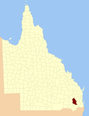
Location within Queensland
Lands administrative divisions around Aubigny:
Lytton Boondooma Fitzroy
Derby Aubigny Cavendish
Derby Merivale Churchill

Parishes

Aubigny is divided into parishes, listed as follows:

ParishLGACoordinatesTowns
BeauarabaToowoomba27°41′S 151°35′EPittsworth
BowenvilleToowoomba27°19′S 151°28′EBowenville
CambooyaToowoomba27°42′S 151°51′ECambooya
Cecil PlainsToowoomba27°38′S 151°22′EBrookstead, Cecil Plains
CliftonToowoomba27°55′S 152°00′EClifton
CumkillenbarWestern Downs27°02′S 151°23′EKaimkillenbun
DalbyWestern Downs27°09′S 151°18′EDalby
DouglasToowoomba27°19′S 151°59′E
DraytonToowoomba27°35′S 151°56′EToowoomba, Drayton
East PrairieToowoomba27°34′S 151°27′E
ElphinstoneToowoomba27°57′S 151°52′E
Eton ValeToowoomba27°39′S 151°53′E
FeltonToowoomba27°51′S 151°40′E
GehamToowoomba27°24′S 152°00′EGeham, Hampton
GoombungeeToowoomba27°17′S 151°53′EGoombungee
GowrieToowoomba27°32′S 151°53′E
HaldonToowoomba27°49′S 152°02′E
HodgsonToowoomba27°48′S 151°50′E
IrvingdaleWestern Downs27°09′S 151°27′E
IsaacToowoomba27°30′S 151°48′EKingsthorpe
JimbourWestern Downs27°00′S 151°16′EJimbour
JondaryanToowoomba27°23′S 151°28′EJondaryan
KingToowoomba27°21′S 151°48′E
MacalisterWestern Downs27°04′S 151°08′EMacalister
Maida HillWestern Downs26°54′S 151°30′EBell
MeringandanToowoomba27°26′S 151°50′EMeringandan
MiltonToowoomba27°10′S 151°46′E
MoolaWestern Downs27°03′S 151°32′E
MotleyToowoomba27°35′S 151°37′E
MyallWestern Downs27°09′S 151°10′E
North BranchToowoomba27°48′S 151°33′E
PiltonToowoomba27°54′S 152°07′EPilton
RamsayToowoomba27°44′S 151°58′E
RollestonToowoomba27°43′S 151°42′EPittsworth, Southbrook
RosalieToowoomba27°09′S 151°37′E
St RuthWestern Downs27°24′S 151°17′ESt Ruth
StephensToowoomba27°56′S 151°46′E
TabletopToowoomba27°57′S 152°00′E
ToothToowoomba27°53′S 151°49′ENobby
ToowoombaToowoomba27°29′S 151°56′ECharlton, Gowrie Jn, Highfields
WattsToowoomba27°22′S 151°40′EOakey
West PrairieToowoomba27°28′S 151°22′E
WestbrookToowoomba27°35′S 151°45′EWestbrook, Biddeston
WienholtWestern Downs27°13′S 151°26′E
YandillaToowoomba27°43′S 151°20′E
YoungToowoomba27°17′S 151°23′E
gollark: The article talks about preserving privacy and such, but this isn't what happened with phones and most people don't seem to care.
gollark: This sounds prone to horrible, horrible data mining but could be very neat.
gollark: It's a shame all the attempts at AR glasses seem to go bankrupt, get bought out by a company which promptly kills it, or get stuck in high end business use forever.
gollark: I finally managed to get HyperRogue to compile and it might be fun.
gollark: <@!239056962980020225> You may also want to check out Jellyfin for media purposes, which is apparently similar to Plex but fully open source.

References

  1. "Aubigny (county) (entry 980)". Queensland Place Names. Queensland Government. Retrieved 31 August 2015.
  2. Darling Downs District, County of Aubigny Maps - A4 Series at Queensland Archives.


This article is issued from Wikipedia. The text is licensed under Creative Commons - Attribution - Sharealike. Additional terms may apply for the media files.