Coulee City, Washington
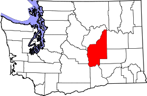
Coulee City is a town in Grant County, Washington. The population was 562 at the 2010 census.
Coulee City | |
|---|---|
| Coulee City, Washington | |
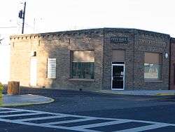
 City hall | |
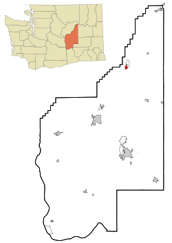
 Location of Coulee City, Washington | |
| Coordinates: 47°36′43″N 119°17′27″W | |
| Country | United States |
| State | Washington |
| County | Grant |
| Area | |
| • Total | 0.97 sq mi (2.50 km2) |
| • Land | 0.92 sq mi (2.39 km2) |
| • Water | 0.04 sq mi (0.11 km2) |
| Elevation | 1,588 ft (484 m) |
| Population | |
| • Total | 562 |
| • Estimate (2019)[3] | 564 |
| • Density | 610.39/sq mi (235.62/km2) |
| Time zone | UTC-8 (Pacific (PST)) |
| • Summer (DST) | UTC-7 (PDT) |
| ZIP code | 99115 |
| Area code | 509 |
| FIPS code | 53-15080 |
| GNIS feature ID | 1512117[4] |
History
The town was named after nearby Grand Coulee.[5] Coulee City was officially incorporated on May 10, 1907.
Geography
Coulee City is located at 47°36′43″N 119°17′27″W (47.611942, -119.290904).[6]
According to the United States Census Bureau, the town has a total area of 0.90 square miles (2.33 km2), all of it land.[7]
Climate
| Climate data for Coulee City, Washington | |||||||||||||
|---|---|---|---|---|---|---|---|---|---|---|---|---|---|
| Month | Jan | Feb | Mar | Apr | May | Jun | Jul | Aug | Sep | Oct | Nov | Dec | Year |
| Record high °F (°C) | 52 (11) |
62 (17) |
73 (23) |
93 (34) |
100 (38) |
103 (39) |
110 (43) |
110 (43) |
101 (38) |
85 (29) |
67 (19) |
56 (13) |
110 (43) |
| Average high °F (°C) | 34 (1) |
41 (5) |
52 (11) |
62 (17) |
71 (22) |
79 (26) |
89 (32) |
87 (31) |
78 (26) |
63 (17) |
44 (7) |
33 (1) |
61 (16) |
| Average low °F (°C) | 21 (−6) |
25 (−4) |
31 (−1) |
35 (2) |
42 (6) |
48 (9) |
55 (13) |
55 (13) |
48 (9) |
37 (3) |
27 (−3) |
21 (−6) |
37 (3) |
| Record low °F (°C) | −19 (−28) |
−19 (−28) |
4 (−16) |
18 (−8) |
24 (−4) |
28 (−2) |
34 (1) |
31 (−1) |
36 (2) |
7 (−14) |
−8 (−22) |
−19 (−28) |
−19 (−28) |
| Average precipitation inches (mm) | 0.83 (21) |
0.97 (25) |
0.99 (25) |
0.77 (20) |
1.06 (27) |
0.81 (21) |
0.69 (18) |
0.46 (12) |
0.50 (13) |
0.59 (15) |
1.37 (35) |
1.41 (36) |
10.45 (268) |
Demographics
| Historical population | |||
|---|---|---|---|
| Census | Pop. | %± | |
| 1910 | 276 | — | |
| 1920 | 472 | 71.0% | |
| 1930 | 420 | −11.0% | |
| 1940 | 744 | 77.1% | |
| 1950 | 977 | 31.3% | |
| 1960 | 654 | −33.1% | |
| 1970 | 558 | −14.7% | |
| 1980 | 510 | −8.6% | |
| 1990 | 568 | 11.4% | |
| 2000 | 600 | 5.6% | |
| 2010 | 562 | −6.3% | |
| Est. 2019 | 564 | [3] | 0.4% |
| U.S. Decennial Census[8] | |||
2010 census
As of the census[2] of 2010, there were 562 people, 265 households, and 150 families living in the town. The population density was 624.4 inhabitants per square mile (241.1/km2). There were 331 housing units at an average density of 367.8 per square mile (142.0/km2). The racial makeup of the town was 91.3% White, 2.1% Native American, 0.2% Asian, 1.6% from other races, and 4.8% from two or more races. Hispanic or Latino of any race were 3.4% of the population.
There were 265 households of which 19.2% had children under the age of 18 living with them, 44.9% were married couples living together, 7.5% had a female householder with no husband present, 4.2% had a male householder with no wife present, and 43.4% were non-families. 37.0% of all households were made up of individuals and 16.2% had someone living alone who was 65 years of age or older. The average household size was 2.10 and the average family size was 2.72.
The median age in the town was 49.1 years. 16.9% of residents were under the age of 18; 7.2% were between the ages of 18 and 24; 19% were from 25 to 44; 33.5% were from 45 to 64; and 23.5% were 65 years of age or older. The gender makeup of the town was 49.6% male and 50.4% female.
2000 census
As of the census of 2000, there were 600 people, 271 households, and 162 families living in the town. The population density was 605.0 people per square mile (234.0/km²). There were 351 housing units at an average density of 353.9 per square mile (136.9/km²). The racial makeup of the town was 94.83% White, 1.00% African American, 0.83% Native American, 0.33% Asian, 0.50% Pacific Islander, 0.17% from other races, and 2.33% from two or more races. Hispanic or Latino of any race were 2.83% of the population.
There were 271 households out of which 25.5% had children under the age of 18 living with them, 48.3% were married couples living together, 10.3% had a female householder with no husband present, and 39.9% were non-families. 36.2% of all households were made up of individuals and 18.5% had someone living alone who was 65 years of age or older. The average household size was 2.21 and the average family size was 2.87.
In the town, the age distribution of the population shows 24.0% under the age of 18, 7.7% from 18 to 24, 21.7% from 25 to 44, 23.7% from 45 to 64, and 23.0% who were 65 years of age or older. The median age was 42 years. For every 100 females, there were 102.7 males. For every 100 females age 18 and over, there were 99.1 males.
The median income for a household in the town was $25,938, and the median income for a family was $42,500. Males had a median income of $31,375 versus $17,250 for females. The per capita income for the town was $14,411. About 14.9% of families and 22.1% of the population were below the poverty line, including 29.2% of those under age 18 and 11.7% of those age 65 or over.
References
- "2019 U.S. Gazetteer Files". United States Census Bureau. Retrieved August 7, 2020.
- "U.S. Census website". United States Census Bureau. Retrieved 2012-12-19.
- "Population and Housing Unit Estimates". United States Census Bureau. May 24, 2020. Retrieved May 27, 2020.
- "Coulee City". Geographic Names Information System. United States Geological Survey.
- Meany, Edmond S. (1923). Origin of Washington geographic names. Seattle: University of Washington Press. p. 58.
- "US Gazetteer files: 2010, 2000, and 1990". United States Census Bureau. 2011-02-12. Retrieved 2011-04-23.
- "US Gazetteer files 2010". United States Census Bureau. Archived from the original on 2012-07-02. Retrieved 2012-12-19.
- United States Census Bureau. "Census of Population and Housing". Retrieved October 5, 2013.
