Corn Creek, South Dakota
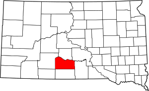
Corn Creek is an unincorporated community and census-designated place in Mellette County, South Dakota, United States. Its population was 105 as of the 2010 census.[1] The community is located near the intersection of South Dakota Highway 44 and South Dakota Highway 63.
Corn Creek, South Dakota | |
|---|---|
 Corn Creek, South Dakota  Corn Creek, South Dakota | |
| Coordinates: 43°33′54″N 101°12′04″W | |
| Country | United States |
| State | South Dakota |
| County | Mellette |
| Area | |
| • Total | 2.103 sq mi (5.45 km2) |
| • Land | 2.040 sq mi (5.28 km2) |
| • Water | 0.063 sq mi (0.16 km2) |
| Elevation | 2,365 ft (721 m) |
| Population | |
| • Total | 105 |
| • Density | 50/sq mi (19/km2) |
| Time zone | UTC-6 (Central (CST)) |
| • Summer (DST) | UTC-5 (CDT) |
| Area code(s) | 605 |
| GNIS feature ID | 1266592[2] |
Geography
According to the U.S. Census Bureau, the community has an area of 2.103 square miles (5.45 km2); 2.040 square miles (5.28 km2) of its area is land, and 0.063 square miles (0.16 km2) is water.[1]
gollark: https://vignette.wikia.nocookie.net/dragcave/images/7/7f/Garland_mature_hatchi.png/revision/latest?cb=20171225233339Look at the garland hatchlings. So circular.
gollark: Much timefulness.
gollark: I was complaining about too few offers on my cheese and ice. Now I have too many.
gollark: The trick is to never pay attention to what you're breeding together.
gollark: 2 groups!
References
- "2010 Census Gazetteer Files - Places: South Dakota". U.S. Census Bureau. Retrieved January 28, 2017.
- "Corn Creek". Geographic Names Information System. United States Geological Survey.
This article is issued from Wikipedia. The text is licensed under Creative Commons - Attribution - Sharealike. Additional terms may apply for the media files.
