Colby, Cumbria
Colby is a village and civil parish in the Eden district of the English county of Cumbria. It is near the village of Bolton to the north and the town of Appleby-in-Westmorland to the east.
| Colby | |
|---|---|
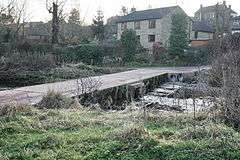 The pipe bridge over Hoff Beck | |
 Colby Location within Cumbria | |
| Population | 129 (2011)[1] |
| OS grid reference | NY6620 |
| Civil parish |
|
| District |
|
| Shire county | |
| Region | |
| Country | England |
| Sovereign state | United Kingdom |
| Post town | APPLEBY IN WESTMORLAND |
| Postcode district | CA16 |
| Dialling code | 01768 |
| Police | Cumbria |
| Fire | Cumbria |
| Ambulance | North West |
| UK Parliament |
|
Transport
For transport there is the A66 road and the B6542 road (the old A66) nearby. Colby is next to the River Eden.
Location grid
Places adjacent to Colby, Cumbria | ||||||||||
|---|---|---|---|---|---|---|---|---|---|---|
| ||||||||||
gollark: Nope, not keywords.
gollark: <@337621533369303042> Was it you who wanted this?
gollark: Takes ages to load words, I'm afraid.
gollark: ```pythonimport thesaurusimport randomimport concurrent.futures as futureswords_to_synonyms = {}synonyms_to_words = {}def add_to_key(d, k, v): d[k] = d.get(k, set()).union(set(v))def add_synonyms(syns, word): for syn in syns: add_to_key(synonyms_to_words, syn, [word]) add_to_key(words_to_synonyms, word, syns)def concat(list_of_lists): return sum(list_of_lists, [])def fetch_word(word): results = concat(thesaurus.Word(word).synonyms("all")) return resultsdef add_words(words): with futures.ThreadPoolExecutor(max_workers=50) as executor: word_futures = {executor.submit(fetch_word, word): word for word in words} for future in futures.as_completed(word_futures): word = word_futures[future] try: data = future.result() except Exception as exc: print(f"Error fetching {word}: {exc}") else: add_synonyms(data, word)def getattr_hook(obj, key): results = list(synonyms_to_words.get(key, set()).union(words_to_synonyms.get(key, set()))) if len(results) > 0: return obj.__getattribute__(random.choice(results)) else: raise AttributeError(f"Attribute {key} not found.")def wrap(obj): add_words(dir(obj)) obj.__getattr__ = lambda key: getattr_hook(obj, key)wrap(__builtins__)__builtins__.engrave("Hi!")```
gollark: Ah yes. Global Interpreter Lock. Right. This may be hard.
See also
References
- "Parish population 2011". Retrieved 23 June 2015.
External links
| Wikimedia Commons has media related to Colby, Cumbria. |
Cumbria Portal | |
| Boroughs or districts | |
| Major settlements |
|
| Topics | |
This article is issued from Wikipedia. The text is licensed under Creative Commons - Attribution - Sharealike. Additional terms may apply for the media files.