Cirque Peak (Alberta)
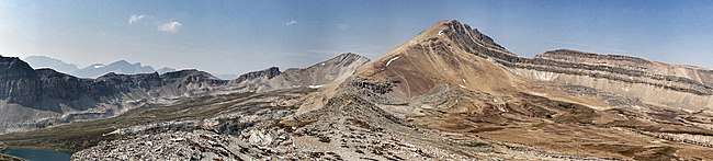
Cirque Peak is a 2,993-metre (9,820-foot) peak located directly west of Dolomite Pass in the Bow River valley of Banff National Park, in the Canadian Rockies of Alberta, Canada.
| Cirque Peak | |
|---|---|
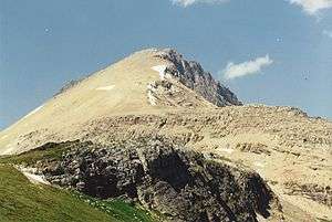 Cirque Peak from Helen Lake, July 1994 | |
| Highest point | |
| Elevation | 2,993 m (9,820 ft) [1] |
| Prominence | 341 m (1,119 ft) [2] |
| Parent peak | Observation Peak[2] |
| Listing | Mountains of Alberta |
| Coordinates | 51°41′59″N 116°25′04″W [2] |
| Geography | |
| Parent range | Canadian Rockies |
| Topo map | NTS 82N/09 |
| Climbing | |
| First ascent | 1899[2][3] |
| Easiest route | Easy Scramble |

Scrambling Route
The scrambling route (rated easy) begins just beyond Helen Lake which can be reached by following the Helen Lake/Dolomite Pass trail 6 km from the trail head beside the Icefields Parkway. From the lake, follow the trail into Dolomite Pass and then choose a line up the peak.[5]
Geology
Like other mountains in Banff Park, Cirque Peak is composed of sedimentary rock laid down during the Precambrian to Jurassic periods.[6] Formed in shallow seas, this sedimentary rock was pushed east and over the top of younger rock during the Laramide orogeny.[7]
Climate
Based on the Köppen climate classification, Cirque Peak is located in a subarctic climate with cold, snowy winters, and mild summers.[8] Temperatures can drop below −20 °C with wind chill factors below −30 °C.
References
- Bow Lake and Saskatchewan Crossing (Map). 1:70,000. Gem Trek Publishing. 2000. ISBN 1-895526-10-8. Archived from the original on 2019-06-09. Retrieved 2019-06-08.
- "Cirque Peak". Bivouac.com. Retrieved 2012-07-01.
- "Cirque Peak". PeakFinder.com. Retrieved 2019-06-08.
- Place-names of Alberta. Ottawa: Geographic Board of Canada. 1928. p. 34. Retrieved 2019-06-08.
- Kane, Alan (1999). "Cirque Peak". Scrambles in the Canadian Rockies. Calgary: Rocky Mountain Books. pp. 222–223. ISBN 0-921102-67-4.
-
Belyea, Helen (1960). "The Story of the Mountains in Banff National Park" (PDF). Geological Survey of Canada. Archived (PDF) from the original on 2 October 2015. Retrieved 2019-05-05. Cite journal requires
|journal=(help) - Gadd, Ben (2008). "Geology of the Rocky Mountains and Columbias". Cite journal requires
|journal=(help) - Peel, M. C.; Finlayson, B. L. & McMahon, T. A. (2007). "Updated world map of the Köppen−Geiger climate classification". Hydrol. Earth Syst. Sci. 11: 1633–1644. ISSN 1027-5606.