Cinfães
Cinfães (Portuguese pronunciation: [sĩˈfɐ̃jʃ] (![]()
Cinfães | |
|---|---|
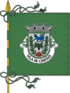
 Flag  Coat of arms | |
 | |
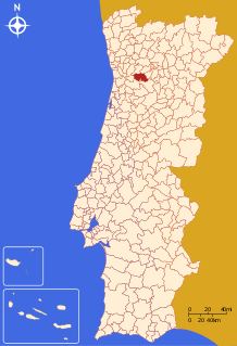
| Coordinates: 41°06′N 8°08′W | |
| Country | |
| Region | Norte |
| Intermunic. comm. | Tâmega e Sousa |
| District | Viseu |
| Parishes | 14 |
| Government | |
| • President | José Manuel Pinto (PS) |
| Area | |
| • Total | 239.29 km2 (92.39 sq mi) |
| Population (2011) | |
| • Total | 20,427 |
| • Density | 85/km2 (220/sq mi) |
| Time zone | UTC±00:00 (WET) |
| • Summer (DST) | UTC+01:00 (WEST) |
| Website | http://www.cm-cinfaes.pt |
Its history is linked to the first king of Portugal, Afonso Henriques and several noblemen of his entourage, like the server Egas Moniz. In Cinfães existed several fortified houses or towers like "Torre da Chã" destroyed during the first half of the 20th century.
It has an important heritage resource, especially the Romanesque churches such as St. Cristóvão de Nogueira; Santa Maria Maior de Tarouquela, Igreja do Escamarão, Ermida do Douro among many important others churches, specially dated to the Baroque period, like the one of São Pedro of Ferreiros de Tendais, and Santa Cristina of Tendais.
The present mayor is Armando Mourisco, elected by the Socialist Party. The municipal holiday is June 24 (st. John's day).
Parishes
Administratively, the municipality is divided into 14 civil parishes (freguesias):[3]
- Alhões, Bustelo, Gralheira e Ramires
- Cinfães
- Espadanedo
- Ferreiros de Tendais
- Fornelos
- Moimenta
- Nespereira
- Oliveira do Douro
- Santiago de Piães
- São Cristóvão de Nogueira
- Souselo
- Tarouquela
- Tendais
- Travanca
References
- Instituto Nacional de Estatística Archived November 15, 2016, at the Wayback Machine
- "Áreas das freguesias, concelhos, distritos e país". Archived from the original on 2018-11-05. Retrieved 2018-11-05.
- Diário da República. "Law nr. 11-A/2013, page 552 40" (pdf) (in Portuguese). Retrieved 21 July 2014.