Chropov
Chropov is a village and municipality in Skalica District in the Trnava Region of western Slovakia.
Chropov | |
|---|---|
Municipality | |
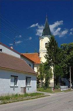 Church of Saint John of Nepomuk | |
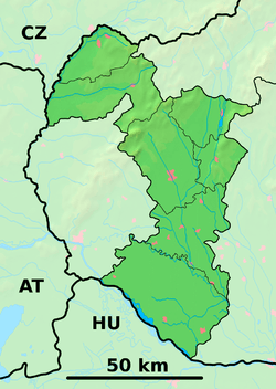 Chropov Location of Chropov in the Trnava Region  Chropov Chropov (Slovakia) | |
| Coordinates: 48°46′N 17°19′E | |
| Country | Slovakia |
| Region | Trnava |
| District | Skalica |
| First mentioned | 1262 |
| Area | |
| • Total | 17.794 km2 (6.870 sq mi) |
| Elevation | 246 m (807 ft) |
| Population | |
| • Total | 355 |
| • Density | 20/km2 (52/sq mi) |
| Time zone | UTC+1 (CET) |
| • Summer (DST) | UTC+2 (CEST) |
| Postal code | 908 64 |
| Area code(s) | 421-34 |
| Car plate | SI |
| Website | chropov.sk |
History
In historical records the village was first mentioned in 1262.
Geography
The municipality lies at an altitude of 246 metres and covers an area of 17.794 km². It has a population of about 355 people.
Genealogical resources
The records for genealogical research are available at the state archive "Statny Archiv in Bratislava, Slovakia"
- Roman Catholic church records (births/marriages/deaths): 1635-1927 (parish A)
gollark: I'm relatively sure that's on switchcraft.
gollark: What's the ID?
gollark: I would only use it to run you out of RAM...
gollark: You're not running it in CCEmuX, then?
gollark: Other than that.
This article is issued from Wikipedia. The text is licensed under Creative Commons - Attribution - Sharealike. Additional terms may apply for the media files.