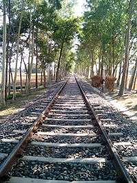
Chilahati–Parbatipur–Santahar–Darshana line
The Chilahati–Parbatipur–Santahar–Darshana line is a railway line connecting Chilahati and Darshana, via Parbatipur Junction, Santahar, Abdulpur, Azim Nagar station (in Gopālpur, Lalpur Upazila), Iswardi and Hardinge Bridge in Bangladesh. This track is under the jurisdiction of Bangladesh Railway.
| Chilahati–Parbatipur–Santahar–Darshana line | |
|---|---|
 Nilphamari-Chilahati Railway line | |
| Overview | |
| Status | Operational |
| Locale | Bangladesh |
| Termini | Chilahati Darshana |
| Stations | 66 |
| Operation | |
| Opened | 1878 |
| Owner | Bangladesh Railway |
| Technical | |
| Line length | ? |
| Number of tracks | ? |
| Track gauge | 1,676 mm (5 ft 6 in) Broad gauge converted to Dual gauge between Iswardi & Saidpur 1,676 mm (5 ft 6 in) & 1,000 mm (3 ft 3 3⁄8 in) |
| Operating speed | ? |
| Chilahati–Parbatipur–Santahar–Darshana line | ||||||||||||||||||||||||||||||||||||||||||||||||||||||||||||||||||||||||||||||||||||||||||||||||||||||||||||||||||||||||||||||||||||||||||||||||||||||||||||||||||||||||||||||||||||||||||||||||||||||||||||||||||||||||||||||||||||||||||||||||||||||||||||||||||||||||||||||||||||||||||||||||||||||||||||||||||||||||||||||||||||||||||||||||||||||||||||||||||||||||||||||||||||||||||||||||||||||||||||||||||||||||||||||||||||||||||||||||||||||||||||||||||||||||||||||||||||||||||||||||||||||||||||||||||||||||||||||||||||||||||||||||||||||||||||||||||||||||||||||||||||||||||||||||||||||||||||||||||||||||||||||||||||||||||||||||||||||||||||||||||||||||||||||||||||||||||||||||||||||||||||||||||||||||||||||||||||||||||||||||||||||||||||||||||||||||||||||||||||||||||||||||||||||||||||||||||||||||||||||||||||||||||||||||||||||||||||||||||||||||||||||||||||||||||||||||||||||||||||||||||||||||||||||||||||||||||||||||||||||||||||||||||||||||
|---|---|---|---|---|---|---|---|---|---|---|---|---|---|---|---|---|---|---|---|---|---|---|---|---|---|---|---|---|---|---|---|---|---|---|---|---|---|---|---|---|---|---|---|---|---|---|---|---|---|---|---|---|---|---|---|---|---|---|---|---|---|---|---|---|---|---|---|---|---|---|---|---|---|---|---|---|---|---|---|---|---|---|---|---|---|---|---|---|---|---|---|---|---|---|---|---|---|---|---|---|---|---|---|---|---|---|---|---|---|---|---|---|---|---|---|---|---|---|---|---|---|---|---|---|---|---|---|---|---|---|---|---|---|---|---|---|---|---|---|---|---|---|---|---|---|---|---|---|---|---|---|---|---|---|---|---|---|---|---|---|---|---|---|---|---|---|---|---|---|---|---|---|---|---|---|---|---|---|---|---|---|---|---|---|---|---|---|---|---|---|---|---|---|---|---|---|---|---|---|---|---|---|---|---|---|---|---|---|---|---|---|---|---|---|---|---|---|---|---|---|---|---|---|---|---|---|---|---|---|---|---|---|---|---|---|---|---|---|---|---|---|---|---|---|---|---|---|---|---|---|---|---|---|---|---|---|---|---|---|---|---|---|---|---|---|---|---|---|---|---|---|---|---|---|---|---|---|---|---|---|---|---|---|---|---|---|---|---|---|---|---|---|---|---|---|---|---|---|---|---|---|---|---|---|---|---|---|---|---|---|---|---|---|---|---|---|---|---|---|---|---|---|---|---|---|---|---|---|---|---|---|---|---|---|---|---|---|---|---|---|---|---|---|---|---|---|---|---|---|---|---|---|---|---|---|---|---|---|---|---|---|---|---|---|---|---|---|---|---|---|---|---|---|---|---|---|---|---|---|---|---|---|---|---|---|---|---|---|---|---|---|---|---|---|---|---|---|---|---|---|---|---|---|---|---|---|---|---|---|---|---|---|---|---|---|---|---|---|---|---|---|---|---|---|---|---|---|---|---|---|---|---|---|---|---|---|---|---|---|---|---|---|---|---|---|---|---|---|---|---|---|---|---|---|---|---|---|---|---|---|---|---|---|---|---|---|---|---|---|---|---|---|---|---|---|---|---|---|---|---|---|---|---|---|---|---|---|---|---|---|---|---|---|---|---|---|---|---|---|---|---|---|---|---|---|---|---|---|---|---|---|---|---|---|---|---|---|---|---|---|---|---|---|---|---|---|---|---|---|---|---|---|---|---|---|---|---|---|---|---|---|---|---|---|---|---|---|---|---|---|---|---|---|---|---|---|---|---|---|---|---|---|---|---|---|---|---|---|---|---|---|---|---|---|---|---|---|---|---|---|---|---|---|---|---|---|---|---|---|---|---|---|---|---|---|---|---|---|---|---|---|---|---|---|---|---|---|---|---|---|---|---|---|---|---|---|---|---|---|---|---|---|---|---|---|---|---|---|---|---|---|---|---|---|---|---|---|---|---|---|---|---|---|---|---|---|---|---|---|---|---|---|---|---|---|---|---|---|---|---|---|---|---|---|---|---|---|---|---|---|---|---|---|---|---|---|---|---|---|---|---|---|---|---|---|---|---|---|---|---|---|---|---|---|---|---|---|---|---|---|---|---|---|---|---|---|---|---|---|---|---|---|---|---|---|---|---|---|---|---|---|---|---|---|---|---|---|---|---|---|---|---|---|---|---|---|---|---|---|---|---|---|---|---|---|---|---|---|---|---|---|---|---|---|---|---|---|---|---|---|---|---|---|---|---|---|---|---|---|---|---|---|---|---|---|---|---|---|---|---|---|---|---|---|---|---|---|---|---|---|---|---|---|---|---|---|---|---|---|---|---|---|---|---|---|---|---|---|---|---|---|---|---|---|---|---|---|---|---|---|---|---|---|---|---|---|---|---|---|---|---|---|---|---|---|---|---|---|---|---|---|---|---|---|---|---|---|---|---|---|---|---|---|---|---|---|---|---|---|---|---|---|---|---|---|---|---|---|---|---|---|---|---|---|---|---|---|---|---|---|---|---|---|---|---|---|---|---|---|---|---|---|---|---|---|---|---|---|---|---|---|---|---|---|---|---|---|---|---|---|---|---|---|---|---|---|---|---|---|---|---|---|---|---|---|---|---|---|---|---|---|---|---|---|---|---|
Source: Bangladesh Railway Route Map | ||||||||||||||||||||||||||||||||||||||||||||||||||||||||||||||||||||||||||||||||||||||||||||||||||||||||||||||||||||||||||||||||||||||||||||||||||||||||||||||||||||||||||||||||||||||||||||||||||||||||||||||||||||||||||||||||||||||||||||||||||||||||||||||||||||||||||||||||||||||||||||||||||||||||||||||||||||||||||||||||||||||||||||||||||||||||||||||||||||||||||||||||||||||||||||||||||||||||||||||||||||||||||||||||||||||||||||||||||||||||||||||||||||||||||||||||||||||||||||||||||||||||||||||||||||||||||||||||||||||||||||||||||||||||||||||||||||||||||||||||||||||||||||||||||||||||||||||||||||||||||||||||||||||||||||||||||||||||||||||||||||||||||||||||||||||||||||||||||||||||||||||||||||||||||||||||||||||||||||||||||||||||||||||||||||||||||||||||||||||||||||||||||||||||||||||||||||||||||||||||||||||||||||||||||||||||||||||||||||||||||||||||||||||||||||||||||||||||||||||||||||||||||||||||||||||||||||||||||||||||||||||||||||||||
History
From 1878, the railway route from Kolkata, then called Calcutta, to Siliguri was in two laps. The first lap was a 185 km journey along the Eastern Bengal State Railway from Calcutta Station (later renamed Sealdah) to Damookdeah Ghat on the southern bank of the Padma River, then across the river in a ferry and the second lap of the journey. A 336 km metre gauge line of the North Bengal Railway linked Saraghat on the northern bank of the Padma to Siliguri.[1]
The 1.8 km Hardinge Bridge across the Padma came up in 1912.[2] In 1926 the metre-gauge section north of the bridge was converted to broad gauge, and so the entire Calcutta - Siliguri route became broad-gauge.[1]
With the partition of India in 1947, the portions of the track in Pakistani territory, later Bangladeshi territory, got separated. The southern portion through Gede is still functional and Maitree Express runs to Kolkata on this track. In the north the Chilahati–Haldibari section has gone out of operation.[3] As of 2010, the 64 kilometres (40 mi) long Saidpur-Chilahati line was in such a bad shape that there was no fast train between Dhaka and Chilahati. In 2010, Taka 103.68 crore was sanctioned for the development of this line.[4]
Branch lines
Sara–Sirajganj Railway Company constructed the Sara–Sirajganj line in 1915–16.[5]
The Brahmaputra–Sultanpur Railway Company constructed the 94 kilometres (58 mi) long metre-gauge railway track from Santahar to Fulchhari (Tistamukh) in 1899–1900. Presently the line is up to Balashi Ghat in Phulchhari Upazila. The 44 kilometres (27 mi) long Bonarpara-Kaunia line was constructed in 1905.[5][6]
North Bengal state railway opened a metre gauge line to Kaunia in 1879. Two narrow gauge lines were laid by Eastern Bengal Railway from Kaunia to Dharla River, thereby creating the Kaunia–Dharlla State Railway. The Kaunia Dharla railway lines were converted to metre gauge in 1901.[7]
References
- "India: the complex history of the junctions at Siliguri and New Jalpaiguri". IRFCA. Retrieved 2011-11-12.
- Chowdhury, Sifatul Quader (2012). "Hardinge Bridge". In Islam, Sirajul; Jamal, Ahmed A. (eds.). Banglapedia: National Encyclopedia of Bangladesh (Second ed.). Asiatic Society of Bangladesh.
- "New rail transit route thru India gets govt nod". Priyo Internet Life. Archived from the original on 2013-06-08. Retrieved 2012-01-28.
- "Work on Saidpur-Chilahati railway project progresses". The Independent, 4 September 2010. Archived from the original on 15 September 2012. Retrieved 2012-01-28.
- "Brief History". Bangladesh Railway. Archived from the original on 2011-12-20. Retrieved 2012-02-07.
- Fida, Quazi Abul (2012). "Railway". In Islam, Sirajul; Jamal, Ahmed A. (eds.). Banglapedia: National Encyclopedia of Bangladesh (Second ed.). Asiatic Society of Bangladesh.
- R.P. Saxena. "Indian Railway History timeline". Archived from the original on 2012-07-14. Retrieved 2012-02-01.