Chesterville, Quebec
Chesterville is a municipality in the Arthabaska district of the Centre-du-Québec (Bois-Francs) region of Quebec, on Route 161 approximately 130 kilometres (81 mi) northeast of Montreal.
Chesterville | |
|---|---|
Municipality | |
 | |
| Nickname(s): Quebec's little Switzerland | |
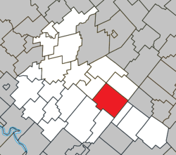 Location within Arthabaska RCM. | |
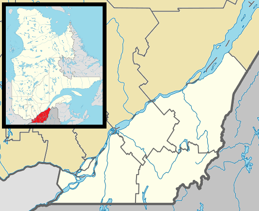 Chesterville Location in southern Quebec. | |
| Coordinates: 45°58′N 71°49′W[1] | |
| Country | |
| Province | |
| Region | Centre-du-Québec |
| RCM | Arthabaska |
| Settled | 1835-1849 |
| Constituted | December 18, 1982 |
| Government | |
| • Mayor | Louis Lafleur |
| • Federal riding | Richmond—Arthabaska |
| • Prov. riding | Drummond–Bois-Francs |
| Area | |
| • Total | 117.00 km2 (45.17 sq mi) |
| • Land | 115.42 km2 (44.56 sq mi) |
| Population (2011)[3] | |
| • Total | 891 |
| • Density | 7.7/km2 (20/sq mi) |
| • Pop 2006-2011 | |
| Time zone | UTC−5 (EST) |
| • Summer (DST) | UTC−4 (EDT) |
| Postal code(s) | G0P 1J0 |
| Area code(s) | 819 |
| Highways | |
| Website | www |
Geography
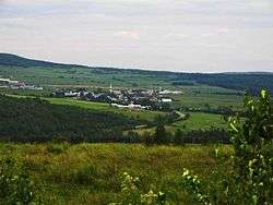
The town's mountainous terrain in the heart of the Canadian Appalachians has earned it the nickname of "Quebec's little Switzerland," and boasts a picturesque location adjacent to the northern Nicolet river.
History
The first settlers to the area arrived in 1835, but colonization actually began in spring 1849 with the establishment of a Catholic parish.
Demographics
The principal source of income in Chesterville is agriculture and forest exploitation.
Attractions
The free annual Symposium L'Accueil des Grands Peintres (art symposium) attracts many art lovers and features exhibits, artist conferences, workshops, local fare, and other cultural activities.
«Clairière - Art et Nature» is a 2 km forest path and natural amphitheatre dedicated to Professional site specific visual arts and musical concerts. Annual week-ends events are presented in August and September; they are open to the public.[4]
References
- Reference number 137697 of the Commission de toponymie du Québec (in French)
- Geographic code 39030 in the official Répertoire des municipalités (in French)
- "(Code 2439030) Census Profile". 2011 census. Statistics Canada. 2012.
External links
- Anderson Machineries (agricultural and forestry machinery manufacturer)
- Centre-du-Québec touristic region
- Groupe Synergy Composites (developer of advanced composite products and technology for the utility vehicle and bus industries)
- Centre-du-Québec
- Clairière - Art et Nature is an organization dedicated to creation and promotion of contemporary visual arts and music.
- Statistics Canada
Places adjacent to Chesterville, Quebec | ||||||||||
|---|---|---|---|---|---|---|---|---|---|---|
| ||||||||||
| Cities |
|
|---|---|
| Municipalities | |
| Parishes |
|
| Townships | |
| |
| Authority control |
|
|---|