Chapirevula
Chapirevula is one of the old villages in Nandyal Mandal of Kurnool district, Andhra Pradesh, India.[1]
Chapirevula | |
|---|---|
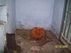 Bangaramma Gudi in Chapirevula | |
.svg.png) Chapirevula Location in Andhra Pradesh, India  Chapirevula Chapirevula (India) | |
| Coordinates: 15.455417°N 78.434143°E | |
| Country | |
| State | Andhra Pradesh |
| District | Kurnool |
| Talukas | Nandyal |
| Area | |
| • Total | 50 km2 (20 sq mi) |
| Population (2011) | |
| • Total | 5,987 |
| • Density | 120/km2 (310/sq mi) |
| Languages | |
| • Official | Telugu |
| Time zone | UTC+5:30 (IST) |
| PIN | 518502 |
| Telephone code | 08514 |
| Vehicle registration | AP 21 |
| Literacy | 50% |
| Climate | 20 to 40 (Köppen) |
Geography
Chapirevula is located at 15.48°N 78.48°E and has an average elevation of 203 metres (666 ft). Chapirevula lies in the western part of Andhra Pradesh. This region is bounded by thick Nallamala forests. A canal from the Telugu Ganga project and SRBC canal flow near Chapirevula making the land fertile.
Demographics
Chapirevula has a population of over 5,000. Males constitute ~48% of the population and females ~52%. Chapirevula has an average literacy rate of 45%: male literacy is ~50%. In Chapirevula, 50% of the population is above 40 years of age as many of the educated left the village to pursue their careers in cities like Nandyal and Hyderabad and foreign countries like the United States of America.
References
- "Gram Panchayat Identification Codes" (PDF). Saakshar Bharat Mission. National Informatics Centre. p. 221. Archived from the original (PDF) on 18 August 2017. Retrieved 25 May 2019.
External links
| District headquarters |  | |
|---|---|---|
| Divisions | ||
| Mandals | ||
| Cities | ||
| Towns | ||
| Census towns |
| |