Catherine, Colorado
Catherine is a census-designated place (CDP) in Garfield County, Colorado, United States. The population as of the 2010 census was 228.[1]
Catherine, Colorado | |
|---|---|
 Catherine  Catherine | |
| Coordinates: 39°24′11″N 107°7′45″W | |
| Country | |
| State | |
| County | Garfield County |
| Area | |
| • Total | 0.87 sq mi (2.25 km2) |
| • Land | 0.87 sq mi (2.25 km2) |
| • Water | 0.0 sq mi (0.0 km2) |
| Elevation | 6,340 ft (1,930 m) |
| Population (2010) | |
| • Total | 228 |
| • Density | 263/sq mi (101.4/km2) |
| Time zone | UTC-7 (MST) |
| • Summer (DST) | UTC-6 (MDT) |
| Area code(s) | 970 |
| FIPS code | 08-12460 |
| GNIS feature ID | 2583220 |
It is located in the southeast corner of Garfield County, in the valley of the Roaring Fork River. Colorado State Highway 82 forms the northern edge of the CDP; it leads northwest 16 miles (26 km) to Glenwood Springs, the Garfield County seat, and southeast 24 miles (39 km) to Aspen. Catherine is bordered to the west by Mulford and to the east by El Jebel in Eagle County. The town of Carbondale is 5 miles (8 km) to the west.
According to the U.S. Census Bureau, the Catherine CDP has an area of 0.87 square miles (2.25 km2), all of it land.[1]
Demographics
| Historical population | |||
|---|---|---|---|
| Census | Pop. | %± | |
| U.S. Decennial Census[2] | |||
gollark: This is a false dichotomy.
gollark: But then I wouldn't have a computer. I need that.
gollark: Well, it's unsafe.
gollark: Really? I've seen a bunch of random Linux programs written in C.
gollark: I agree that writing everything in intensely horrific JS is bad. I just don't think that much application software which is currently written in C would become worse if written in something safer and higher level.
See also
- Outline of Colorado
- State of Colorado
- Colorado cities and towns
- Colorado census designated places
- Colorado counties
- Colorado cities and towns
References
- "Geographic Identifiers: 2010 Demographic Profile Data (G001): Catherine CDP, Colorado". American Factfinder. U.S. Census Bureau. Retrieved November 16, 2016.
- "Census of Population and Housing". Census.gov. Retrieved June 4, 2016.
| Wikimedia Commons has media related to Catherine, Colorado. |
Municipalities and communities of Garfield County, Colorado, United States | ||
|---|---|---|
| Cities | 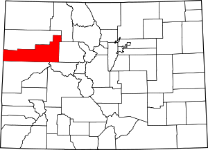 Map of Colorado highlighting Garfield County | |
| Towns | ||
| CDPs | ||
| Unincorporated communities | ||
This article is issued from Wikipedia. The text is licensed under Creative Commons - Attribution - Sharealike. Additional terms may apply for the media files.