Caneyville Township, Chautauqua County, Kansas
Caneyville Township is a township in Chautauqua County, Kansas, USA. As of the 2000 census, its population was 88.
Caneyville Township | |
|---|---|
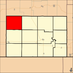 Location in Chautauqua County | |
| Coordinates: 37°15′10″N 096°27′21″W | |
| Country | United States |
| State | Kansas |
| County | Chautauqua |
| Area | |
| • Total | 55.7 sq mi (144.27 km2) |
| • Land | 55.49 sq mi (143.72 km2) |
| • Water | 0.21 sq mi (0.55 km2) 0.38% |
| Elevation | 1,037 ft (316 m) |
| Population (2000) | |
| • Total | 88 |
| • Density | 1.6/sq mi (0.6/km2) |
| GNIS feature ID | 0485518 |
Geography
Caneyville Township covers an area of 55.7 square miles (144 km2) and contains no incorporated settlements. According to the USGS, it contains three cemeteries: New Cloverdale, Old Cloverdale and Pleasant Valley.
The streams of Squaw Creek and Wolf Creek run through this township.
gollark: Maybe you missed a `do` in a `while` or `for` thingy.
gollark: It is also helpful to post the code involved, or a screenshot.
gollark: Yes. I'd like to recommend that you lead with a question next time, to probably get faster responses.
gollark: It uses four though.
gollark: Same maths as GPS trilateration.
External links
Municipalities and communities of Chautauqua County, Kansas, United States | ||
|---|---|---|
| Cities | 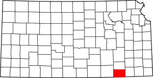 Map of Kansas highlighting Chautauqua County | |
| Unincorporated communities | ||
| Townships | ||
This article is issued from Wikipedia. The text is licensed under Creative Commons - Attribution - Sharealike. Additional terms may apply for the media files.