Candlelight Farms Airport
Candlelight Farms Airport (FAA LID: 11N), is located in New Milford, Connecticut, United States.
Candlelight Farms Airport | |||||||||||
|---|---|---|---|---|---|---|---|---|---|---|---|
| Summary | |||||||||||
| Airport type | Public | ||||||||||
| Owner | Terry McClinch | ||||||||||
| Operator | Terry McClinch | ||||||||||
| Serves | New Milford | ||||||||||
| Location | |||||||||||
| Elevation AMSL | 675 ft / 206 m | ||||||||||
| Coordinates | 41°34′09″N 73°27′43″W | ||||||||||
| Map | |||||||||||
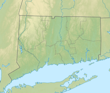 11N Location of airport in Connecticut/United States  11N 11N (the United States) | |||||||||||
| Runways | |||||||||||
| |||||||||||
| Statistics (2010) | |||||||||||
| |||||||||||
Facilities and aircraft
Candlelight Farms Airport is situated 3 miles southwest of the central business district, and contains 1 runway. The runway is turf measuring 2,900 x 50 ft (884 x 15 m).
For the 12-month period ending April 30, 2010, the airport had 10,950 aircraft operations, an average of 30 per day: 86% local general aviation, and 14% transient general aviation. At that time there were 14 aircraft based at this airport: 100% single-engine.[2]
Accidents and incidents
- On the morning of August 11, 2017, a Cessna 172 carrying a pilot and 2 passengers crashed, killing one person.
gollark: They give you money if you're unemployed *maybe* subject to some preconditions because government, and you *maybe* pay taxes (here, people below a certain income don't).
gollark: It doesn't actually work like that exactly.
gollark: Not *really*.
gollark: Or general "big global problem insurance".
gollark: I suppose someone more libertarian-leaning than me would argue for no government support at all and just having "pandemic insurance" or something.
References
- FAA Airport Master Record for 42B (Form 5010 PDF), effective 2010-11-18
- AirNav: 11N - Candlelight Farms Airport
External links
- Resources for this airport:
- FAA airport information for 11N
- AirNav airport information for 11N
- FlightAware airport information and live flight tracker
- SkyVector aeronautical chart for 11N
This article is issued from Wikipedia. The text is licensed under Creative Commons - Attribution - Sharealike. Additional terms may apply for the media files.