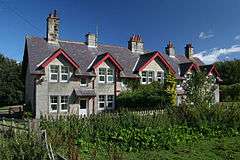
Callaly
Callaly is a village in Northumberland, England. It is about 9 miles (14 km) to the west of Alnwick. The main A697 road (to Morpeth) is 3 miles (5 km) away. It is on the line of the Roman road linking the Roman forts of High Rochester to the west and Learchild to the east, where it joins the Devil's Causeway Roman road to the north.
| Callaly | |
|---|---|
 | |
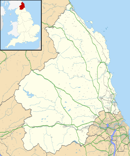 Callaly Location within Northumberland | |
| Population | 235 (2011 census including Cartington)[1] |
| OS grid reference | NU055095 |
| District | |
| Shire county | |
| Region | |
| Country | England |
| Sovereign state | United Kingdom |
| Post town | ALNWICK |
| Postcode district | NE66 |
| Dialling code | 01665 |
| Police | Northumbria |
| Fire | Northumberland |
| Ambulance | North East |
| UK Parliament | |
Landmarks
Callaly Castle, a Grade 1 listed building, is located just north of the village.
Dancing Hall is located outside of Callaly Village.
gollark: Oh, sorry! I mean SHUT UP YOU WORTHLESS USER IF YOU DO NOT IMMEDIATELY GET IT ALL RIGHT YOU ARE A FAILURE.
gollark: Huh. Unexpected.
gollark: You are really not very good at this whole "teaching" thing.
gollark: I don't really Java but```javapublic class Grass extends Item { public Grass() { super() namePlural = "Grass" name = "Grass" }}```might be closer.
gollark: Apparently.
References
- "Parish population 2011". Retrieved 1 July 2015.
This article is issued from Wikipedia. The text is licensed under Creative Commons - Attribution - Sharealike. Additional terms may apply for the media files.