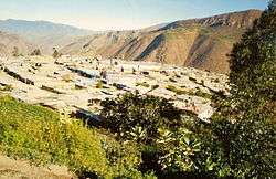
Cajacay District
Cajacay District is one of fifteen districts of the Bolognesi Province in Peru.[1]
Cajacay | |
|---|---|
 | |
| Country | |
| Region | Ancash |
| Province | Bolognesi |
| Founded | January 2, 1857 |
| Capital | Cajacay |
| Government | |
| • Mayor | Joaquin Edmundo Castillo Sarazu |
| Area | |
| • Total | 193.06 km2 (74.54 sq mi) |
| Elevation | 2,599 m (8,527 ft) |
| Population (2005 census) | |
| • Total | 1,748 |
| • Density | 9.1/km2 (23/sq mi) |
| Time zone | UTC-5 (PET) |
| UBIGEO | 020505 |
Geography
One of the highest peaks of the district is Kushuru Punta at approximately 4,800 m (15,700 ft). Other mountains are listed below:[2]
- Chakwa Pukyu
- Ch'illka Raqra
- Hatun Punta
- Hirkan Wayi
- Ichik Punta
- Inka Waqanqa
- Kima Wank'a
- Mina Punta
- Pichaq Wayin
- Qucha Marka
- Quraw
- Tuku Wachanan
- Yana Punta
- Yuraq Punta
gollark: Dragon kind of had that - you used a keyboard to type into a turtle and it'd send items over an introspection module to you.
gollark: (autocrafting coming as soon as I figure out how my previous crafting job solver worked and port it)
gollark: It is arguably pretty next-generation. It's designed to function more like AE2, with one server, multiple terminals and automation.
gollark: Hah, squid's artist thread is called "Previous-Generation Plethora Storage".
gollark: The forums seem quite quiet.
References
- (in Spanish) Instituto Nacional de Estadística e Informática. Banco de Información Distrital Archived April 23, 2008, at the Wayback Machine. Retrieved April 11, 2008.
- escale.minedu.gob.pe/ UGEL map Carlos Fermín Fitzcarrald Province (Ancash Region)
This article is issued from Wikipedia. The text is licensed under Creative Commons - Attribution - Sharealike. Additional terms may apply for the media files.