Bytów County
Bytów County (Kashubian: bëtowsczi pòwiat, Polish: powiat bytowski) is a unit of territorial administration and local government (powiat) in Pomeranian Voivodeship, northern Poland. It came into being on January 1, 1999, as a result of the Polish local government reforms passed in 1998. Its administrative seat and largest town is Bytów, which lies 79 kilometres (49 mi) west of the regional capital Gdańsk. The only other town in the county is Miastko, lying 37 km (23 mi) west of Bytów.
Bytów County Powiat bytowski | |
|---|---|
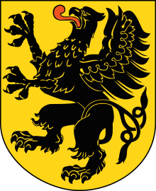
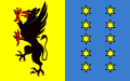 Flag  Coat of arms | |
.svg.png) Division into gminas | |
| Coordinates (Bytów): 54°8′N 17°30′E | |
| Country | |
| Voivodeship | Pomeranian |
| Seat | Bytów |
| Gminas | |
| Area | |
| • Total | 2,192.81 km2 (846.65 sq mi) |
| Population (2006) | |
| • Total | 75,313 |
| • Density | 34/km2 (89/sq mi) |
| • Urban | 27,702 |
| • Rural | 47,611 |
| Car plates | GBY |
| Website | http://www.powiatbytowski.pl/ |
The county covers an area of 2,192.81 square kilometres (846.6 sq mi). As of 2006 its total population is 75,313, out of which the population of Bytów is 16,715, that of Miastko is 10,987, and the rural population is 47,611.
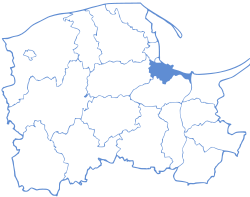
Bytów County on a map of the counties of Pomeranian Voivodeship
Bytów County is bordered by Słupsk County to the north, Lębork County to the north-east, Kartuzy County and Kościerzyna County to the east, Chojnice County and Człuchów County to the south, and Szczecinek County and Koszalin County to the west.
Local Government
District head
- Leszek Pałasz (1998-2001)
- Andrzej Hrycyna p.o. (2001-2002)
- Michał Świątek-Brzeziński (2002-2006)
- Roman Zaborowski (2006-2007)
- Jacek Żmuda-Trzebiatowski (2007-2015)
- Leszek Waszkiewicz (od 2015)
Vice district head
- Andrzej Hrycyna (1998-2002)
- Tomasz Borowski (2002-2006)
- Krzysztof Sławski (2006-2010)
- Andrzej Marcinkowski (2010-2014)
- Zbigniew Batko (od 2014)
Chairman of the county council
- Mieczysław Bachórz (1998-2002)
- Jerzy Jobczyk (2002-2006)
- Andrzej Hrycyna (od 2006)
Administrative division
The county is subdivided into 10 gminas (two urban-rural and eight rural). These are listed in the following table, in descending order of population.
| Gmina | Type | Area (km²) |
Population (2006) |
Seat |
| Gmina Bytów | urban-rural | 197.4 | 23,568 | Bytów |
| Gmina Miastko | urban-rural | 466.8 | 19,765 | Miastko |
| Gmina Czarna Dąbrówka | rural | 298.3 | 5,626 | Czarna Dąbrówka |
| Gmina Lipnica | rural | 309.6 | 4,796 | Lipnica |
| Gmina Kołczygłowy | rural | 173.3 | 4,321 | Kołczygłowy |
| Gmina Tuchomie | rural | 106.5 | 3,915 | Tuchomie |
| Gmina Trzebielino | rural | 225.5 | 3,716 | Trzebielino |
| Gmina Studzienice | rural | 176.0 | 3,408 | Studzienice |
| Gmina Parchowo | rural | 130.9 | 3,407 | Parchowo |
| Gmina Borzytuchom | rural | 108.6 | 2,791 | Borzytuchom |