Busia District
Busia District is a district in the Eastern region of Uganda.
Busia District | |
|---|---|
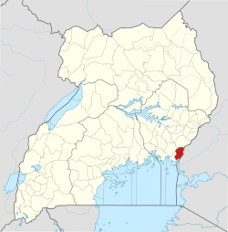 District location in Uganda | |
| Coordinates: 00°23′N 34°00′E | |
| Country | Uganda |
| Region | Eastern Region of Uganda |
| Capital | Busia |
| Area | |
| • Land | 730.9 km2 (282.2 sq mi) |
| Population (2012 Estimate) | |
| • Total | 297,600 |
| • Density | 407.2/km2 (1,055/sq mi) |
| Time zone | UTC+3 (EAT) |
| Website | www |
Location
Busia District borders Tororo District to the north, Busia County, Kenya to the east, Tanzania to the south, Namayingo District to the south-west, and Bugiri District to the west. Busia, Uganda, the site of the district headquarters, is approximately 35 km (22 mi) by road south of Tororo, the nearest large town.[1]
Population
During the 1991 national population census, the population in the district was estimated at 163,600. In 2002, the national census estimated the population at 225,000. In 2012, the mid-year population of was estimated at 297,600.[2]
Notable people
Notable people from Busia District include:
- Aggrey Awori - Former Uganda Minister of Information Technology (2009-2011)
- Barbara Nekesa Oundo, former state minister for Karamoja affairs and the Busia District women's representative in the parliament (since 2011)
- Benjamin Joseph Odoki, former chief justice of Uganda
- James Munange Ogoola, former principal judge of Uganda
- Denis Onyango, Ugandan international association football goalkeeper
- Gabriel Opio, former minister of gender, culture and labour (2009-2011)
- Fred Wabwire-Mangen, professor of epidemiology, Makerere University School of Public Health
- Kevinah Taaka Wanaha Wandera, former Member of Parliament, Busia Municipality (2011-2016)
- Barnabas Nawangwe, Professor of Architecture and current Vice Chancellor of Makerere University
Points of interest
The following points of interest are in the district:
- Majanji landing site on Lake Victoria for fish, which is one of the main foods in the district.
- Busitema Forest is roughly 25 km2 (10 sq mi); it is bisected by the main highway between Uganda and Kenya in Busia.
gollark: Spawners take upward of 320RF/t.
gollark: Yes, a backup power source.
gollark: How do you plan to make enough? Endergenics seem the best approach.
gollark: So we can run it for a bit at glacial speed off my solar panel, then build and configure an endergenic generator, and hopefully run it off that.
gollark: Actually, RFTools has endergenic generators... with very careful design you can get millions of RF from ender pearls.
See also
References
- "Road Distance Between Tororo And Busia With Map". Globefeed.com. Retrieved 10 May 2014.
- "Estimated Population of Busia District In 1991, 2002 & 2012". Citypopulaton.de. Retrieved 9 May 2014.
This article is issued from Wikipedia. The text is licensed under Creative Commons - Attribution - Sharealike. Additional terms may apply for the media files.