Brown Township, Hancock County, Indiana
Brown Township is one of nine townships in Hancock County, Indiana, United States. As of the 2010 census, its population was 2,571 and it contained 1,067 housing units.[1]
Brown Township | |
|---|---|
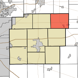 Location in Hancock County | |
| Coordinates: 39°54′23″N 85°38′02″W | |
| Country | United States |
| State | Indiana |
| County | Hancock |
| Government | |
| • Type | Indiana township |
| Area | |
| • Total | 30.82 sq mi (79.8 km2) |
| • Land | 30.76 sq mi (79.7 km2) |
| • Water | 0.06 sq mi (0.2 km2) 0.19% |
| Elevation | 971 ft (296 m) |
| Population (2010) | |
| • Total | 2,571 |
| • Density | 83.6/sq mi (32.3/km2) |
| GNIS feature ID | 0453137 |
History
Brown Township was organized in 1833. It was named for Prior Brown, a pioneer settler.[2]
Geography
According to the 2010 census, the township has a total area of 30.82 square miles (79.8 km2), of which 30.76 square miles (79.7 km2) (or 99.81%) is land and 0.06 square miles (0.16 km2) (or 0.19%) is water.[1] The streams of Harlan Run, Maize Run, McCray Run, Shirley Drain and Village Brook run through this township.
Unincorporated towns
(This list is based on USGS data and may include former settlements.)
Adjacent townships
- Adams Township, Madison County (north)
- Greensboro Township, Henry County (east)
- Harrison Township, Henry County (east)
- Wayne Township, Henry County (southeast)
- Jackson Township (south)
- Green Township (west)
- Fall Creek Township, Madison County (northwest)
Cemeteries
The township contains five cemeteries: McCray, Harlan, Hayes (twp), Gard (twp) and Reeves (twp).
Major highways
gollark: Actually, I added some bodges to potatOS to make potatoshutdownpotatos work okay.
gollark: It should *probably* be designed to only open one socket connection at once, like modern skynets.
gollark: Ah, I see.
gollark: One issue with websockets which isn't really an issue for most setups is that since potatOS has about two open at once (skynet & SPUDNET) and the limit is quite low, it may not be possible to use websocket chatbox + potatOS.
gollark: test
References
- "Brown Township, Hancock County, Indiana". Geographic Names Information System. United States Geological Survey. Retrieved 2009-09-24.
- United States Census Bureau cartographic boundary files
- "Population, Housing Units, Area, and Density: 2010 - County -- County Subdivision and Place -- 2010 Census Summary File 1". United States Census. Archived from the original on 2020-02-12. Retrieved 2013-05-10.
- Binford, John H. (1882). History of Hancock County, Indiana: From Its Earliest Settlement by the "pale Face," in 1818, Down to 1882. King & Binford. pp. 88.
External links
Municipalities and communities of Hancock County, Indiana, United States | ||
|---|---|---|
| City | Map of Indiana highlighting Hancock County | |
| Towns | ||
| Townships | ||
| Unincorporated communities | ||
| Footnotes | ‡This populated place also has portions in an adjacent county or counties | |
This article is issued from Wikipedia. The text is licensed under Creative Commons - Attribution - Sharealike. Additional terms may apply for the media files.