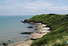
Brittas Bay
Brittas Bay (Irish: Cuan an Bhriotáis) in County Wicklow, Ireland is a 4 kilometres (2.5 mi) stretch of beach on the Irish Sea coast, about 12 kilometres (7.5 mi) south of Wicklow. The beach and associated dunes are very popular with Dubliners and are one of the most frequented beaches by residents of the capital during the summer.[1]
Geography

The 4 kilometres (2.5 mi) long beach is accessed from the R750 regional road which runs parallel to the beach, separated from it by extensive areas of sand dunes. It is 12 kilometres (7.5 mi) by road south of Wicklow and about 65 kilometres (40 mi) south of the city centre of Dublin.[2] Brittas Bay is in the civil parish of Dunganstown in the barony of Arklow on the southern coast of County Wicklow.[3]
History
There was a Christian settlement in nearby Three-Mile-Water prior to St Patrick's arrival in Ireland. This settlement was presided over by a Roman prelate Palladius, who was sent by Cellestine to Ireland in 431 AD. He was assisted by two monks named Sylvester and Solinus.[4] Later St Baoithin ruled over a monastery in the area and one of his pupils was St Kevin who founded the Christian settlement in Glendalough.[5]
A 17th Century smuggler and pirate Captain Jack White operated from Jack's Hole, a secluded cove where he intercepted goods from British merchant ships and imported goods from France to the annoyance of Crown authorities who were thus deprived of customs revenue.[6]
Until the end of September 2012 Bus Éireann route 2 used to stop at Jack White's Cross numerous times each day. There was considerable public dissatisfaction with the decision to terminate the route.[7] The stop at Jack White's Cross was subsequently reinstated in the route 2 timetable from 25 August 2013.[8]
Landmarks
Several caravan parks are in the vicinity including Staunton's Caravan Site, O'Drischoll's Caravan Park and Brittas Bay Park. The European Club golf club is to the south near the hamlet of Ardanary on Mizen Head. Dunganstown Castle lies to the northeast of Brittas Bay.[2]
References
- Paul Cullen, Ken Boyle (1995). "Dublin, Wicklow & the Boyne Valley". McGraw-Hill. p. 157.CS1 maint: uses authors parameter (link)
- Brittas Bay, Google Maps, Retrieved 28 March 2020.
- "Cuan an Bhriotáis". Irish Placenames Database. 2016. Retrieved 25 September 2016.
- "Mission of St Palladius". Libraryireland,com. Retrieved 28 March 2020.
- "Three Mile Water, Brittas Bay: PURE Mile". County Wicklow Heritage. Retrieved 28 March 2020.
- "Jack White's Pub History". Jack White's Inn. Retrieved 28 March 2020.
- "Non Stop". Wicklow People. 9 October 2012. Retrieved 28 March 2020.
- "Bus Ãeireann Enhances Wexford to Dublin Airport Expressway Route 2 with Additional Stops". Buseireann.iedate=19 August 2013. Retrieved 28 March 2020.