Bracalba, Queensland
Bracalba is a rural locality of the Moreton Bay Region in Queensland, Australia.[2]
| Bracalba Queensland | |||||||||||||||
|---|---|---|---|---|---|---|---|---|---|---|---|---|---|---|---|
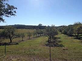
 Orchard, Gamgee Road, 2015 | |||||||||||||||
 Bracalba | |||||||||||||||
| Coordinates | 27°S 152.83°E | ||||||||||||||
| Population | 162 (2011 census)[1] | ||||||||||||||
| Postcode(s) | 4512 | ||||||||||||||
| LGA(s) | Moreton Bay Region | ||||||||||||||
| State electorate(s) | Glass House | ||||||||||||||
| Federal Division(s) | Longman | ||||||||||||||
| |||||||||||||||
Geography
A large portion of the northern half of Bracalba lies within Beerburrum West State Forest.
History
The name is derived from the Wakawaka language, and refers to the scrub areas of the D'Aguilar Range.[2]
Ferndale Provisional School opened on 19 April 1892. On 1 January 1909 it became Ferndale State School. In 1913 it was renamed Bracalba State School. It closed in 1941.[3]
In the 2011 census, the suburb recorded a population of 162 persons, with a median age of 32 years.[1]
gollark: Anomalous connectivity issues.
gollark: Hold on. I have to unmute my microphone.
gollark: Hi.
gollark: It has been 3, and it is done.
gollark: I will have to update the server's software, which will take at least 3.
References
- Australian Bureau of Statistics (31 October 2012). "Bracalba (State Suburb)". 2011 Census QuickStats. Retrieved 27 January 2020.

- "Bracalba (entry 45366)". Queensland Place Names. Queensland Government. Retrieved 30 May 2014.
- Queensland Family History Society (2010), Queensland schools past and present (Version 1.01 ed.), Queensland Family History Society, ISBN 978-1-921171-26-0
This article is issued from Wikipedia. The text is licensed under Creative Commons - Attribution - Sharealike. Additional terms may apply for the media files.