Bourne Brook
The Bourne Brook or Black Brook, as it is known in its upper reaches, is a tributary of the River Tame in Staffordshire, England.[2]
| Bourne Brook | |
|---|---|
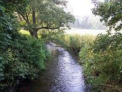 Bourne Brook near Hints | |
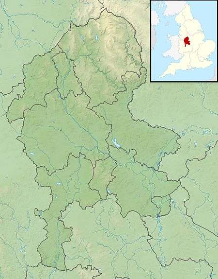 Confluence with the River Tame shown in Staffordshire | |
| Location | |
| Country | England |
| Counties | Staffordshire |
| District | Lichfield District |
| Town | Fazeley |
| Villages | Shenstone, Weeford, Hints |
| Physical characteristics | |
| Source | |
| • location | Aldridge, Staffordshire |
| Mouth | |
• location | Fazeley, Staffordshire |
• coordinates | 52.6123°N 1.6921°W |
| Length | 14 km (8.7 mi)[1] |
| Basin size | 35 km2 (14 sq mi)[1] |
| Progression : Bourne Brook—Tame—Trent—Humber | |
Course
From its source near Aldridge (originally in Staffordshire, but now in the West Midlands county), where it is known as the Black Brook, it flows north, to the west and north of the village of Shenstone, then flows east past Weeford and Hints where the name changes to the Bourne Brook. It then continues through the grounds of Drayton Manor Theme Park and then to its confluence with the River Tame near Fazeley.[2]
Its waters ultimately flow, via the Humber Estuary, into the North Sea.
gollark: Too bad, consume bees.
gollark: People get weird and obsessive about it, or annoyed if you leave their messages for 6 years or something.
gollark: Message read receipts were a mistake.
gollark: A void chamber with very transparent glass.
gollark: > implying the moon is real
References
- "Water Framework Directive Surface Water Classification Status and Objectives 2012 csv files". Environment-agency.gov.uk. Archived from the original on 24 February 2014. Retrieved 20 April 2013.
- "Get-a-map online". Ordnance Survey. Retrieved 26 March 2013.
This article is issued from Wikipedia. The text is licensed under Creative Commons - Attribution - Sharealike. Additional terms may apply for the media files.