Bouladuff
Bouladuff (Irish: An Bhuaile Dhubh),[2] also known as Inch and The Ragg,[3] is a village near Thurles in County Tipperary, Ireland. According to the 2016 CSO census, the population of the Inch electoral division was 395.[1] Bouladuff is in the barony of Eliogarty.
Bouladuff An Bhuaile Dhubh | |
|---|---|
Village | |
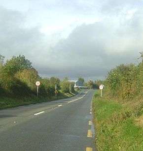 Entrance to Bouladuff R498 | |
 Bouladuff Location in Ireland | |
| Coordinates: 52°43′02″N 7°54′40″W | |
| Country | Ireland |
| Province | Munster |
| County | County Tipperary |
| Population (2016)[1] | 395 |
| (Inch Electoral Division) | |
Location and access
Bouladuff (also known as Inch) lies 5 miles from Thurles and 3 miles from Borrisoleigh. The village is set in the Suir valley and bounded by the Silvermine Mountains to the northwest and the Slieveardagh hills to the Southeast. The main road is the R498 regional road from Nenagh to Thurles. The area around Bouladuff has views of the Devils Bit and Tower mountains.
Amenities
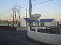
Amenities in the area include Inch National school, Inch Community Hall, and Inch Church (the latter 200 years old).
The village is served by a nightclub and bar, a petrol station and shop, and a restaurant.
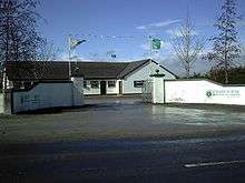
The GAA grounds of Drom-Inch GAA club have dressing room facilities and a covered stand.
Gallery
 Inch National School
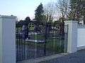 Bouladuff Cemetery
References
- http://census.cso.ie/sapmap2016/Results.aspx?Geog_Type=ED3409&Geog_Code=2AE196291C5713A3E055000000000001
- "Placenames Database of Ireland". Dublin City University. Retrieved 6 February 2015.
- "Moves Afoot to Inch Out The Ragg". Tipperary Star. 21 June 2008. Archived from the original on 13 September 2012. Retrieved 2008-11-17.
External links
- Ragg Settlement Plan
- Inch National School
- Monroe Roman Catholic Church - Buildings of Ireland
- Bouladuff House - Buildings of Ireland