Blyford
Blyford (formerly known as Blythford) is a village and civil parish in the East Suffolk district of Suffolk, England, about 3 miles (5 km) east of Halesworth and separated from Wenhaston by the River Blyth, Suffolk to the south.[1] It is in the civil parish of Sotherton.
| Blyford | |
|---|---|
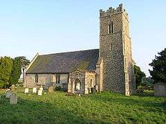
 Church of All Saints, Blyford | |
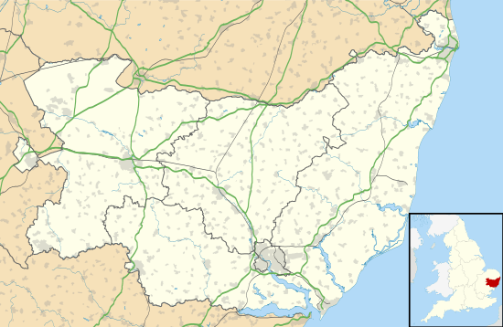
 Blyford Location within Suffolk | |
| Population | 110 (2001 census) |
| OS grid reference | TM4276 |
| District |
|
| Shire county | |
| Region | |
| Country | England |
| Sovereign state | United Kingdom |
| Post town | Halesworth |
| Postcode district | IP19 |

| |
Population in 1801 was 163 and by 1840 had risen to 223. In 1861 the population was 193.[2]
In 1870–72, John Marius Wilson's Imperial Gazetteer of England and Wales described Blyford like this:
Blyford, formerly Blythford, is a parish in Blything district, Suffolk; on the river Blythe, 2½ miles E by S of Halesworth r. station. Post Town, Halesworth. Acres, 947. Real property, £1,548. Pop., 193. Houses, 41. The living is a donative in the diocese of Norwich. Value, not reported. Patron, the Rev. Jeremy Day. The church, made of mainly flint, has two Norman doors and a perpendicular English tower, but is mainly decorated English.
On 9 August 2010, BBC Radio Suffolk reported at the 14th/15th century thatched Queen's Head Inn. The inn sign features St Etheldreda as the Queen. Chickens are located at the inn. The thatched roof was replaced in 1988 after a fire.
The church is just across the road from the inn with rumours of a smugglers' passage being located there. The church was built in 1088, with a 13th-century font added.[3]
References
- White, William. "History, gazetteer and directory of Suffolk". History, gazetteer and directory of Suffolk. Simpkin Marshall and Company, 1874, p. 233.
- Coke, Charles A. Population gazetteer of England and Wales. "History, gazetteer and directory of Suffolk". Harrison, 1864, p. 24.
- "All Saints Blyford". Archived from the original on 10 September 2011. Retrieved 22 August 2011.