Blue Mound, Illinois
Blue Mound is a village in Macon County, Illinois, United States. The population was 1,158 at the 2010 census, and 1,082 at a 2018 estimate. It is included in the Decatur, Illinois Metropolitan Statistical Area.
Blue Mound | |
|---|---|
Village | |
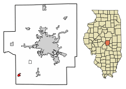 Location of Blue Mound in Macon County, Illinois. | |
.svg.png) Location of Illinois in the United States | |
| Coordinates: 39°41′59″N 89°7′19″W | |
| Country | United States |
| State | Illinois |
| County | Macon |
| Area | |
| • Total | 0.58 sq mi (1.52 km2) |
| • Land | 0.58 sq mi (1.52 km2) |
| • Water | 0.00 sq mi (0.00 km2) |
| Elevation | 616 ft (188 m) |
| Population (2010) | |
| • Total | 1,158 |
| • Estimate (2019)[2] | 1,072 |
| • Density | 1,832.48/sq mi (707.32/km2) |
| Time zone | UTC-6 (CST) |
| • Summer (DST) | UTC-5 (CDT) |
| Area code(s) | 217 |
| FIPS code | 17-06756 |
| Wikimedia Commons | Blue Mound, Illinois |
Geography
Blue Mound is located at 39°41′59″N 89°7′19″W (39.699677, -89.122075).[3]
According to the 2010 census, Blue Mound has a total area of 0.59 square miles (1.53 km2), all land.[4]
One and a half miles north west of the village is located a glacial kame, a cone-shaped gravel hill rising 80 feet above the surrounding farm land. Surrounded by the Griswold Conservation Area, park and camping place, the mound is estimated to date from about 130,000 years ago in geologic time from melting of glacier ice. It is one of a group of glacial mounds in the Blue Mound area.[5]
Demographics
| Historical population | |||
|---|---|---|---|
| Census | Pop. | %± | |
| 1880 | 532 | — | |
| 1890 | 696 | 30.8% | |
| 1900 | 714 | 2.6% | |
| 1910 | 900 | 26.1% | |
| 1920 | 881 | −2.1% | |
| 1930 | 817 | −7.3% | |
| 1940 | 811 | −0.7% | |
| 1950 | 886 | 9.2% | |
| 1960 | 1,038 | 17.2% | |
| 1970 | 1,181 | 13.8% | |
| 1980 | 1,338 | 13.3% | |
| 1990 | 1,161 | −13.2% | |
| 2000 | 1,129 | −2.8% | |
| 2010 | 1,158 | 2.6% | |
| Est. 2019 | 1,072 | [2] | −7.4% |
| U.S. Decennial Census[6] | |||
As of the census[7] of 2000, there were 1,129 people, 459 households, and 329 families residing in the village. The population density was 1,898.9 people per square mile (738.8/km2). There were 483 housing units at an average density of 812.4 per square mile (316.1/km2). The racial makeup of the village was 99.65% White, 0.18% Native American, 0.09% from other races, and 0.09% from two or more races. Hispanic or Latino of any race were 0.27% of the population.
There were 459 households, out of which 34.0% had children under the age of 18 living with them, 56.0% were married couples living together, 11.1% had a female householder with no husband present, and 28.3% were non-families. 24.6% of all households were made up of individuals, and 15.0% had someone living alone who was 65 years of age or older. The average household size was 2.46 and the average family size was 2.91.
In the village, the population was spread out, with 25.2% under the age of 18, 8.9% from 18 to 24, 28.8% from 25 to 44, 20.7% from 45 to 64, and 16.4% who were 65 years of age or older. The median age was 36 years. For every 100 females, there were 90.7 males. For every 100 females age 18 and over, there were 90.3 males.
The median income for a household in the village was $44,018, and the median income for a family was $49,432. Males had a median income of $36,354 versus $21,081 for females. The per capita income for the village was $20,039. About 2.7% of families and 4.2% of the population were below the poverty line, including 6.2% of those under age 18 and 4.0% of those age 65 or over.
References
- "2019 U.S. Gazetteer Files". United States Census Bureau. Retrieved July 14, 2020.
- "Population and Housing Unit Estimates". United States Census Bureau. May 24, 2020. Retrieved May 27, 2020.
- "US Gazetteer files: 2010, 2000, and 1990". United States Census Bureau. 2011-02-12. Retrieved 2011-04-23.
- "G001 - Geographic Identifiers - 2010 Census Summary File 1". United States Census Bureau. Archived from the original on 2020-02-13. Retrieved 2015-08-02.
- "Griswold Conservation Area". maconcountyconservation.org. Macon County Conservation District. Retrieved November 27, 2016.
- "Census of Population and Housing". Census.gov. Retrieved June 4, 2015.
- "U.S. Census website". United States Census Bureau. Retrieved 2008-01-31.
Municipalities and communities of Macon County, Illinois, United States | ||
|---|---|---|
| Cities | Map of Illinois highlighting Macon County | |
| Villages | ||
| Townships | ||
| CDP | ||
| Other unincorporated communities |
| |
| Ghost towns |
| |
| Authority control |
|
|---|