Bishop Monkton
Bishop Monkton is a village and civil parish in the Harrogate district of North Yorkshire, England, about five miles south of Ripon. According to the 2001 census it had a population of 775, increasing slightly to 778 at the 2011 Census.[1]
| Bishop Monkton | |
|---|---|
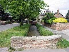 Bishop Monkton Beck | |
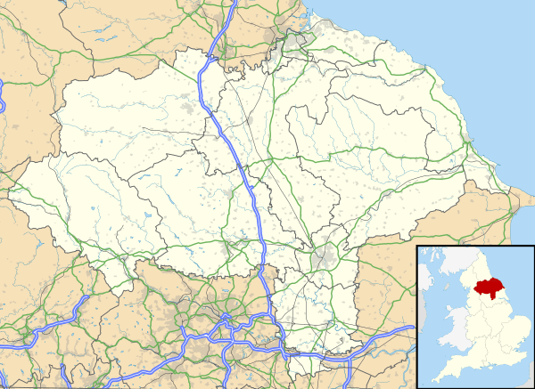 Bishop Monkton Location within North Yorkshire | |
| Population | 778 (2011) |
| OS grid reference | SE329661 |
| District |
|
| Shire county | |
| Region | |
| Country | England |
| Sovereign state | United Kingdom |
| Post town | HARROGATE |
| Postcode district | HG3 |
| Dialling code | 01765 |
| Police | North Yorkshire |
| Fire | North Yorkshire |
| Ambulance | Yorkshire |
| UK Parliament | |
Main features of the village include a beck which runs through the centre of the village, two churches (St John the Baptist [C of E] and a Methodist church), a newly built village hall and playing fields, a primary school, two pubs and two caravan sites.
It is within easy reach of Ripon and Harrogate (via the A61). Leeds and York are both less than an hour's drive.
Littlethorpe and Burton Leonard are the nearest villages.
History
Settlement in Bishop Monkton dates back over 1000 years by visitors who came over the North Sea and travelled up the Ouse. More recent major developments include a council estate built in the 1960s, and two more housing estates built at the south-eastern tip of the village. in 1986 a rural area to the east of the village, Bishop Monkton Ings, was designated a Site of Special Scientific Interest (SSSI) by Natural England.[2]
Governance
An electoral ward in the same name exists. This ward stretches to the north, south and east of the parish with a total population taken at the 2011 census of 2,842.[3]
References
- "Parish population 2011". Neighbourhood Statistics. Office for National Statistics. Retrieved 3 August 2015.
- Newton, Joanne (1 October 1986). "Designated sites view, details: Bishop Monkton Ings SSSI". designatedsites.naturalengland.org.uk. Natural England. Retrieved 20 December 2019.
- "Key Figures for 2011 Census: Key Statistics – Area: Bishop Monkton (Ward)". Neighbourhood Statistics. Office for National Statistics. Retrieved 9 December 2016.