Biharamulo District
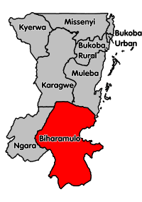
Biharamulo District is one of the eight districts of the Kagera Region of Tanzania. It is bordered to the north by Karagwe District and Muleba District, to the east and south by Geita Region, to the west by Ngara District, and to the southwest by the Kigoma Region. Its administrative seat is Biharamulo town. Biharamulo Game Reserve is located within the borders of the district.
Biharamulo District | |
|---|---|
 Biharamulo District's location within Kagera Region. | |
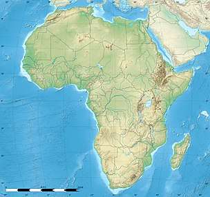
 Biharamulo District Biharamulo District's location within Kagera Region.  Biharamulo District Biharamulo District (Africa) .svg.png) Biharamulo District Biharamulo District (Earth) | |
| Coordinates: 02°38′S 031°19′E | |
| Country | Tanzania |
| Region | Kagera Region |
| Population (2012) | |
| • Total | 323,486 |
| Area code(s) | 028 |
| Website | www |
According to the 2002 Tanzania National Census, the population of the Biharamulo District was 410,794.
According to the 2012 Tanzania National Census, the population of Biharamulo District was 323,486.[1] This decline in population can be explained from the fact that Chato District was split off from Biharamulo District in between the 2002 and the 2012 census.
Transport
Administrative subdivisions
In 2002 the district was divided into 21 wards, but many of these are now part of Chato District. As of 2012, Biharamulo District was administratively divided into 15 wards.[1]
Wards
|
|
|
Sources
External links
References
- "Census 2012". National Bureau of Statistics. Archived from the original on March 5, 2016. Retrieved 9 December 2015.
- "Trunk and Regional Roads in Tanzania". Tanroads. Archived from the original on 8 December 2015. Retrieved 1 December 2015.