Bertha Peak
Bertha Peak is a 2,454-metre (8,051-foot) mountain summit located in Waterton Lakes National Park, in the Canadian Rockies of Alberta, Canada. It is situated behind the Waterton townsite. Its nearest higher peak is Mount Alderson, 2.0 km (1.2 mi) to the southwest.[1] Bertha Lake lies at the southern foot of the peak, with Mount Richards on the opposite side of the lake. Mount Crandell lies to the north.
| Bertha Peak | |
|---|---|
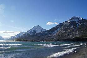
 Bertha Peak, northeast aspect | |
| Highest point | |
| Elevation | 2,454 m (8,051 ft) [1] |
| Prominence | 168 m (551 ft) [1] |
| Parent peak | Mount Alderson (2692 m) |
| Coordinates | 49°02′30″N 113°56′24″W [2] |
| Geography | |
 Bertha Peak Location of Bertha Peak in Alberta  Bertha Peak Bertha Peak (Canada) | |
| Location | Alberta, Canada |
| Parent range | Clark Range[3] Canadian Rockies |
| Topo map | NTS 82H04[2] |
| Geology | |
| Age of rock | Cambrian |
| Type of rock | sedimentary rock |
| Climbing | |
| Easiest route | Scrambling |
History
Bertha Peak was named by Morrison P. Bridgland in 1914 after Bertha Ekelund (1898–1962), a wayward woman and early resident of Waterton who gained notoriety for trying to pass counterfeit money.[1] [4] Morrison P. Bridgland (1878–1948), was a Dominion Land Surveyor who named many peaks in the Canadian Rockies.[5]
The mountain's name was officially adopted in 1953 by the Geographical Names Board of Canada.[2]
Geology
Like other mountains in Waterton Lakes National Park, Bertha Peak is composed of sedimentary rock laid down during the Precambrian to Jurassic periods. Formed in shallow seas, this sedimentary rock was pushed east and over the top of younger Cretaceous period rock during the Laramide orogeny.[6]
Climate
Based on the Köppen climate classification, Bertha Peak is located in a subarctic climate zone with cold, snowy winters, and mild summers.[7] Temperatures can drop below −20 °C with wind chill factors below −30 °C. Precipitation runoff from Bertha Peak drains into Waterton Lake, thence Waterton River.
See also
- Geology of Alberta
- Mountains of Alberta
References
- "Bertha Peak". Bivouac.com. Retrieved 2019-01-15.
- "Bertha Peak". Geographical Names Data Base. Natural Resources Canada. Retrieved 2019-01-15.
- Clark RangePeakbagger
- Being Bertha: How A Wayward Woman Became a Local Legend, Author Fran Genereux, Friesen Press, 2017, ISBN 978-1-5255-0251-4, page 44
- Mapper of Mountains M.P. Bridgland in the Canadian Rockies 1902-1930, Author I.S. MacLaren, The University of Alberta Press, ISBN 0-88864-456-6
- Gadd, Ben (2008). "Geology of the Rocky Mountains and Columbias". Cite journal requires
|journal=(help) - Peel, M. C.; Finlayson, B. L. & McMahon, T. A. (2007). "Updated world map of the Köppen−Geiger climate classification". Hydrol. Earth Syst. Sci. 11: 1633–1644. ISSN 1027-5606.
External links
- Bertha Peak weather forecast
- Parks Canada web site: Waterton Lakes National Park