Berreman Township, Jo Daviess County, Illinois
Berreman Township is one of twenty-three townships in Jo Daviess County, Illinois, USA. As of the 2010 census, its population was 147 and it contained 73 housing units.[2] It was formed from Pleasant Valley Township on February 14, 1857.
Berreman Township | |
|---|---|
 Location in Jo Daviess County | |
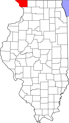
 Jo Daviess County's location in Illinois | |
| Coordinates: 42°14′25″N 89°56′23″W | |
| Country | United States |
| State | Illinois |
| County | Jo Daviess |
| Established | February 14, 1857 |
| Government | |
| • Supervisor | Daniel Caswell |
| Area | |
| • Total | 17.94 sq mi (46.5 km2) |
| • Land | 17.94 sq mi (46.5 km2) |
| • Water | 0 sq mi (0 km2) 0% |
| Elevation | 866 ft (264 m) |
| Population (2010) | |
| • Estimate (2016)[1] | 141 |
| • Density | 8.2/sq mi (3.2/km2) |
| Time zone | UTC-6 (CST) |
| • Summer (DST) | UTC-5 (CDT) |
| ZIP codes | 61053, 61062, 61085 |
| FIPS code | 17-085-05495 |
Geography
According to the 2010 census, the township has a total area of 17.94 square miles (46.5 km2), all land.[2]
Adjacent townships
- Wards Grove Township (north)
- Jefferson Township, Stephenson County (east)
- Freedom Township, Carroll County (south)
- Pleasant Valley Township (west)
- Stockton Township (northwest)
Cemeteries
The township contains Clay Cemetery.
School districts
- Pearl City Community Unit School District 200
- Stockton Community Unit School District 206
- West Carroll Community Unit School District 314
Political districts
- Illinois' 16th congressional district
- State House District 89
- State Senate District 45
gollark: ++remind "19:30 tomorrow" sorry, oops
gollark: ++remind "7am tomorrow" find shirt!
gollark: ++remind "18:00 tomorrow" rolling good, actually
gollark: ++remind 8h harvest earphones from wherever tbeh wwntt
gollark: ++remind 9h "shoulder roll" good, copy/generate SSH key on smartphone
References
- "Berreman Township, Jo Daviess County, Illinois". Geographic Names Information System. United States Geological Survey. Retrieved 2010-01-17.
- United States Census Bureau 2007 TIGER/Line Shapefiles
- United States National Atlas
- "Population and Housing Unit Estimates". Retrieved June 9, 2017.
- "Population, Housing Units, Area, and Density: 2010 - County -- County Subdivision and Place -- 2010 Census Summary File 1". United States Census. Archived from the original on 2020-02-12. Retrieved 2013-05-28.
- "Census of Population and Housing". Census.gov. Retrieved June 4, 2016.
External links
This article is issued from Wikipedia. The text is licensed under Creative Commons - Attribution - Sharealike. Additional terms may apply for the media files.