Bennington Township, Michigan
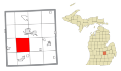
Bennington Township is a civil township of Shiawassee County in the U.S. state of Michigan. As of the 2010 census, the township population was 3,168.[3] Bennington Township is the center of population of the state of Michigan.[4]
Bennington Township, Michigan | |
|---|---|
 Location within Shiawassee County | |
 Bennington Township Location within the state of Michigan | |
| Coordinates: 42°55′10″N 84°13′04″W | |
| Country | United States |
| State | Michigan |
| County | Shiawassee |
| Established | 1838 |
| Government | |
| • Supervisor | Leonard Ash |
| • Clerk | Donna Ash |
| Area | |
| • Total | 36.81 sq mi (95.3 km2) |
| • Land | 35.48 sq mi (91.9 km2) |
| • Water | 1.33 sq mi (3.4 km2) |
| Elevation | 823 ft (251 m) |
| Population (2010) | |
| • Total | 3,168 |
| • Density | 89.3/sq mi (34.5/km2) |
| Time zone | UTC-5 (Eastern (EST)) |
| • Summer (DST) | UTC-4 (EDT) |
| ZIP code(s) | |
| Area code(s) | 989 |
| FIPS code | 26-07280[1] |
| GNIS feature ID | 1625913[2] |
| Website | Official website |
The township was established in 1838 and was named after Bennington, Vermont, which was the former home of the first settlers in the area.[5]
Communities
- Bennington is an unincorporated community in the township. It is located at 42°56′07″N 84°14′31″W[6] at Bennington and Ruess roads.
- Pittsburg is an unincorporated community in the township. Pittsburg was named for Moses Pitts, the original owner of the town site.[5] It is located at latitude 42°53′33″N 84°13′19″W.[7]
History
The first government land purchase was made by Samuel Nicols, Israel Parsons and Benjamin Powers in 1835. Nicols became the first settler in Bennington.[5]
At a location called Hartwellville, the first store was opened by Giles Tucker. In 1838, Johnathon M. Hartwell, formerly of Norwich, NY, took over from Tucker.[5]
Bennington Township was organized on March 6, 1838 with the area of township area 5 North Range 2, the future Perry Township, split off from Shiawassee Township.[8] The first township supervisor was Lemuel Castle.[5] Perry Township was separated off by an act on March 15, 1841.[8] A rail station was opened at the Bennington community.[9]
On February 11, 1841, Hartwell became the first postmaster for the Hartwell post office. On December 13, 1848, a post office was opened in Bennington village with first postmaster Benjamin Davis.[5]
By 1878, there was a hamlet called Alton in the township. Alton was 8/10 of a mile west of Morrice Road on Grand River Trail. The hamlet later abandoned becoming a ghost town.[5]
The Hartwell family served as postmaster until the Hartwell office closed on January 15, 1901. Later Hartwellville was abandoned. The Bennington post office was discontinued on February 28, 1958.[5]
Geography
According to the United States Census Bureau, the township has a total area of 36.81 square miles (95.34 km2), of which 35.48 square miles (91.89 km2) is land and 1.33 square miles (3.44 km2) (3.61%) is water.[3]
The Looking Glass River flows through Bennington Township.
Demographics
As of the census[1] of 2010, there were 3,168 people, 1,252 households, and 906 families residing in the township. The population density was 82.7 per square mile (31.9/km2). There were 1,252 housing units at an average density of 30.4 per square mile (11.7/km2). The racial makeup of the township was 97.58% White, 0.17% African American, 0.30% Native American, 0.46% Asian, 0.53% from other races, and 0.96% from two or more races. Hispanic or Latino of any race were 1.72% of the population.
There were 1,252 households, out of which 35.8% had children under the age of 18 living with them, 75.5% were married couples living together, 5.9% had a female householder with no husband present, and 15.6% were non-families. 12.8% of all households were made up of individuals, and 4.5% had someone living alone who was 65 years of age or older. The average household size was 2.80 and the average family size was 3.05.
In the township the population was spread out, with 26.1% under the age of 18, 6.5% from 18 to 24, 29.4% from 25 to 44, 28.1% from 45 to 64, and 9.9% who were 65 years of age or older. The median age was 38 years. For every 100 females, there were 100.9 males. For every 100 females age 18 and over, there were 99.6 males.
The median income for a household in the township was $54,786, and the median income for a family was $60,609. Males had a median income of $40,465 versus $31,528 for females. The per capita income for the township was $21,841. About 2.3% of families and 3.1% of the population were below the poverty line, including 1.1% of those under age 18 and 4.6% of those age 65 or over.
Highways
References
- "U.S. Census website". United States Census Bureau. Retrieved 2008-01-31.
- U.S. Geological Survey Geographic Names Information System: Bennington Township, Michigan
- "Michigan: 2010 Population and Housing Unit Counts 2010 Census of Population and Housing" (PDF). 2010 United States Census. United States Census Bureau. September 2012. p. 42 Michigan. Retrieved May 1, 2020.
- United States Census Bureau (2020). "Centers of Population: 2010". Retrieved May 22, 2020.
- "Ghost towns and post offices of Shiawassee County". The Argus-Press. September 15, 2000. p. 3. Retrieved 30 April 2015.
- U.S. Geological Survey Geographic Names Information System: Bennington, Michigan
- U.S. Geological Survey Geographic Names Information System: Pittsburg, Michigan
- Epstein, Michael (July 1, 1986). "County Also Marks 150". The Argus-Press. pp. F11. Retrieved 4 May 2015.
- Romig, Walter (1986). Michigan Place Names: The History of the Founding and the Naming of More Than Five Thousand Past and Present Michigan Communities. Wayne State University Press. p. 55. ISBN 9780814318386. Retrieved March 1, 2019.
