Bayshore station (Ottawa)
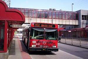
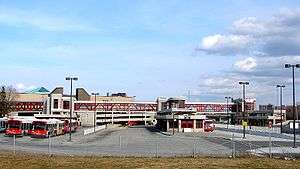
Bayshore is a station on Ottawa, Ontario, Canada's transitway served by OC Transpo buses. It is located in the western transitway section at the Bayshore Shopping Centre in the neighbourhood of Bayshore.[1][2]
Bayshore | |||||||||||||||||||||||
|---|---|---|---|---|---|---|---|---|---|---|---|---|---|---|---|---|---|---|---|---|---|---|---|
| Ottawa Transitway station | |||||||||||||||||||||||
 | |||||||||||||||||||||||
| Location | Ottawa, Ontario Canada | ||||||||||||||||||||||
| Coordinates | 45°20′45″N 75°48′34″W | ||||||||||||||||||||||
| Owned by | OC Transpo | ||||||||||||||||||||||
| Platforms | 4 | ||||||||||||||||||||||
| Construction | |||||||||||||||||||||||
| Parking | No | ||||||||||||||||||||||
| Bicycle facilities | Yes | ||||||||||||||||||||||
| Other information | |||||||||||||||||||||||
| Station code | 3050 | ||||||||||||||||||||||
| History | |||||||||||||||||||||||
| Opened | December 14, 2000 | ||||||||||||||||||||||
| Services | |||||||||||||||||||||||
| |||||||||||||||||||||||
Prior to its construction, buses used Woodridge Crescent and entered the shopping centre parking lot, which is prone to congestion and extensive delays. Due to no access to westbound Woodridge Crescent from Bayshore Drive northbound (except emergency vehicles), routes 11, 82, 97, and 173 have to travel around the shopping centre, on Richmond Road and Holly Acres Road, to enter the small bus-route access to the station. Eastbound trips of routes 11, 82, 97, and 173 travel on Woodridge Crescent eastbound, then on Bayshore Drive southbound, and then their regular route from Richmond Road onward.
A second platform allows rapid route 61 to pass through the station via a new transitway segment between Pinecrest station and Bayshore station,[2][3] which was built in 2009. All Kanata and Stittsville Connexion routes serve this stop at the station.[2][3] Due to service reorganization in the Crystal Beach area with the elimination of old express route 59, select route 61 trips start at Bayshore Station as an extension of local route 152.
As of 2 September 2018, frequent route 11 is no longer serving Richmond Road west of Croydon Avenue, including Bayshore Station. Service will be available at Lincoln Fields station and on Richmond Road east of Croydon Avenue. Route 85 on Carling Avenue and route 97 on Richmond Road continue to serve Bayshore Station after 2 September 2018.
In mid-October, route 153 was extended to/from Bayshore station as a limited local route to/from Tunney's Pasture station via Lincoln Fields, Richmond Road, Westboro station, Wellington Street West, and Holland Avenue, as a way to alleviate the removal of route 11 west of Croydon Avenue.
Service
The following routes serve Bayshore station as of October 6 2019:[4]
Key | |
|---|---|
| O-Train | |
| 98 39 | Rapid routes |
| 40 11 | Frequent routes |
| 55 173 | Local routes |
| 298 | Connexion routes |
| 406 | 300s: Shopper routes 400s: Event routes 600s: School routes |
|
Additional info:
| |
| Stop | Routes |
|---|---|
| 1A Transitway West | 61 62 63 64 66 251 252 256 257 258 261 262 263 264 265 266 267 268 301 303 404 406 |
| 2A Transitway East | 55 61 62 63 64 66 251 252 256 257 258 261 262 263 264 265 266 267 268 283 301 303 454 |
| 3A Local East | 57 58 158 |
| 4A Local West | 58 82 155 173 |
| 4B Local West | 57 85 153 |
References
- "OC Transpo - Transitway Stations". octranspo.com. Retrieved 2014-08-23.
- "Bayshore Area Map - BAY" (PDF). octranspo.com. Retrieved 2014-08-23.
- "Bayshore Station Layout - BAY" (PDF). octranspo.com. Retrieved 2014-08-23.
- "Bayshore | OC Transpo". Retrieved December 5, 2019.
External links
OC Transpo services in Ottawa | |||||||||||||||||||||
|---|---|---|---|---|---|---|---|---|---|---|---|---|---|---|---|---|---|---|---|---|---|
| |||||||||||||||||||||
| |||||||||||||||||||||
| |||||||||||||||||||||