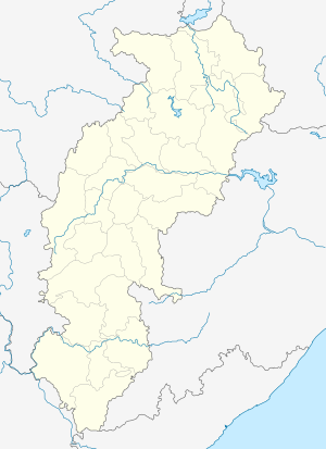
Balrampur, Chhattisgarh
Balrampur is the headquarters of Balrampur-Ramanujganj district of the Indian state of Chhattisgarh.It is a obscure town but after it was named district headquarter of the newly established district the population is growing fastly. It is 441 km North of the state headquarters Raipur.
Balrampur | |
|---|---|
town | |
 Balrampur Location in Chhattisgarh, India  Balrampur Balrampur (India) | |
| Coordinates: 23.605°N 83.617°E | |
| Country | |
| State | Chhattisgarh |
| District | Balrampur |
| Population (2011) | |
| • Total | 4,456 |
| Languages | |
| • Official | Hindi, Surgujiha |
| Time zone | UTC+5:30 (IST) |
| PIN | 497119 |
| Telephone code | 07831 |
| Vehicle registration | CG-30 |
| Website | balrampur |
Geography
It is an important junction Connecting Ambikapur, Ramanujganj, Kusmi and Pratappur and Rajpur.
Facilities
- District Collectorate composite building (4 km from city in Ramanujganj road)
- State police training centre
- District hospital
- District Police Station & State Police Office Balrampur
- Pawai waterfall( 10 km from city)
Transport
Road
Balrampur has collectorate of the district and well connected by all towns of district. National highway 343 connects to Garhwa Jharkhand and Ambikapur Chhattisgarh. Via Ramanujganj Garhwa Jharkhand is accessible. It is linked with Ambikapur, India Via Jhalaria → Rajpur → Baghima -> Ambikapur.
Rail
The nearest railway station are Ambikapur and Garhwa.
gollark: What? That's Lyricly.
gollark: Okay, done.
gollark: Shipped.
gollark: Just one?
gollark: Optionally.
References
This article is issued from Wikipedia. The text is licensed under Creative Commons - Attribution - Sharealike. Additional terms may apply for the media files.