Bainbridge, Pennsylvania
Bainbridge is a census-designated place located in Conoy Township in Lancaster County, Pennsylvania, with a ZIP code of 17502. Bainbridge is located along Pennsylvania Route 441. As of the 2010 census the popululation was 1,355 residents.[1]
Bainbridge, Pennsylvania | |
|---|---|
 Bainbridge Location within the U.S. state of Pennsylvania  Bainbridge Bainbridge (the United States) | |
| Coordinates: 40°05′27″N 76°40′03″W | |
| Country | United States |
| State | Pennsylvania |
| County | Lancaster |
| Population (2010) | |
| • Total | 1,355 |
| Time zone | UTC-5 (Eastern (EST)) |
| • Summer (DST) | UTC-4 (EDT) |
| ZIP codes | 17502 |
| Area code(s) | 717 and 223 |
Prior to European settlement, Bainbridge was the site of a Conoy village in the first decades of the 18th century, possibly called Conejoholo.[2][3]
History
Bainbridge eventually became home to the Conoys and Nanticokes tribes back in the early 1700s when the English settlers pushed them out of their original home. Prior to the move, the Conoys lived in modern-day Baltimore and the Nanticokes lived across the Chesapeake Bay, in modern-day Delaware. In 1632 there were about 2,500 among the tribes and by 1697 there were only about 300 due to diseases brought over by the English.
Tourism
White Cliffs
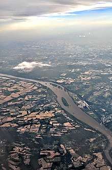
The White Cliffs of Conoy are quite old, but have only recently been open to the public. The cliffs look out over the Susquehanna River and are the direct result of the limestone quarry.
Koser Park
Koser Park is the starting point of a paved trail that stretches 15 miles (24 km) long. The trail goes through Marietta, Pennsylvania and Columbia, Pennsylvania
References
- "Census Bureau Homepage". census.gov. Retrieved 2014-01-24.
- "NPAP Where/When Demo Opening Map Page". Hiddenhistory.com. Retrieved 2013-12-25.
- "C- Pennsylvania Indian Villages, Towns and Settlements". Access Genealogy. 2013-10-18. Retrieved 2013-12-25.
