Baimuru Rural LLG
Baimuru Rural LLG is a local-level government (LLG) of Gulf Province, Papua New Guinea.[1][2]
Baimuru Rural LLG | |
|---|---|
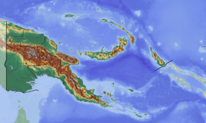
 Baimuru Rural LLG Location within Papua New Guinea | |
| Coordinates: 7.495832°S 144.826322°E | |
| Country | Papua New Guinea |
| Province | Gulf Province |
| Time zone | UTC+10 (AEST) |
Wards
- 01. Amipoke (Ipiko language speakers[3])
- 03. Karurua Station
- 04. Bekoro
- 05. Mariki
- 06. Varia
- 07. Korovake
- 08. Ara'ava
- 09. Kaiarimai
- 10. Kapuna
- 11. Kinibo
- 12. Ikinu
- 13. Akoma
- 14. Mapaio
- 15. Aikavaravi
- 16. Maipenairu
- 17. Kapai
- 18. Apiope
- 19. Aumu
- 20. Poroi
- 21. Wabo
- 22. Uraru
- 23. Haia
- 80. Baimuru Station
gollark: Kitten: fear applied pataphysics.
gollark: https://open.spotify.com/album/7tZo2dx2IQc8FSKuGYhfJQ
gollark: I'm glad we have a Haskell to Rust transpiler now.
gollark: My entry incorporates my universal segfault handler, fortunately.
gollark: coral is not studying economics because coral understands economics optimally.
References
- "Census Figures by Wards – Southern Region". www.nso.gov.pg. 2011 National Population and Housing Census: Ward Population Profile. Port Moresby: National Statistical Office, Papua New Guinea. 2014.
- "Final Figures". www.nso.gov.pg. 2011 National Population and Housing Census: Ward Population Profile. Port Moresby: National Statistical Office, Papua New Guinea. 2014.
- Evans, Nicholas (2018). "The languages of Southern New Guinea". In Palmer, Bill (ed.). The Languages and Linguistics of the New Guinea Area: A Comprehensive Guide. The World of Linguistics. 4. Berlin: De Gruyter Mouton. pp. 641–774. ISBN 978-3-11-028642-7.
- OCHA FISS (2018). "Papua New Guinea administrative level 0, 1, 2, and 3 population statistics and gazetteer". Humanitarian Data Exchange. 1.31.9.
- United Nations in Papua New Guinea (2018). "Papua New Guinea Village Coordinates Lookup". Humanitarian Data Exchange. 1.31.9.
This article is issued from Wikipedia. The text is licensed under Creative Commons - Attribution - Sharealike. Additional terms may apply for the media files.