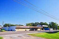
Baileyton, Alabama
Baileyton is a town in Cullman County, Alabama, United States. At the 2010 census the population was 610.[3]
Baileyton, Alabama | |
|---|---|
 Baileyton | |
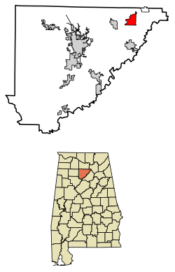 Location of Baileyton in Cullman County, Alabama. | |
| Coordinates: 34°16′1″N 86°36′10″W | |
| Country | United States |
| State | Alabama |
| County | Cullman |
| Government | |
| • Type | Mayor-Council |
| • Mayor | Johnny Dyar |
| Area | |
| • Total | 5.31 sq mi (13.77 km2) |
| • Land | 5.25 sq mi (13.61 km2) |
| • Water | 0.06 sq mi (0.16 km2) |
| Elevation | 984 ft (300 m) |
| Population (2010) | |
| • Total | 610 |
| • Estimate (2019)[2] | 619 |
| • Density | 117.79/sq mi (45.48/km2) |
| Time zone | UTC-6 (Central (CST)) |
| • Summer (DST) | UTC-5 (CDT) |
| ZIP code | 35019 |
| Area code(s) | 256 |
| FIPS code | 01-03676 |
| GNIS feature ID | 0113366 |
The town's mayor is Johnny Dyar.[4]
History
Baileyton was settled in 1870 by Robert Bailey, a farmer from Georgia. A post office was established in Baileyton in 1883. The town was incorporated in 1973.[5]
Geography
Baileyton is located in northeastern Cullman County at 34°16′2″N 86°36′11″W (34.267139, -86.603018).[6] The town lies northeast of the city of Cullman along State Route 69, with its municipal boundary reaching northeastward to State Route 67. The town of Fairview lies just to the west along SR 69, and the Joppa community lies opposite SR 67 to the northeast.
According to the U.S. Census Bureau, the town has a total area of 5.3 square miles (13.8 km2), of which 5.3 square miles (13.6 km2) is land and 0.04 square miles (0.1 km2), or 1.06%, is water.[3]
Demographics
| Historical population | |||
|---|---|---|---|
| Census | Pop. | %± | |
| 1970 | 341 | — | |
| 1980 | 396 | 16.1% | |
| 1990 | 352 | −11.1% | |
| 2000 | 684 | 94.3% | |
| 2010 | 610 | −10.8% | |
| Est. 2019 | 619 | [2] | 1.5% |
| U.S. Decennial Census[7] 2013 Estimate[8] | |||
2000 Census data
As of the census[9] of 2000, there were 684 people, 281 households, and 196 families in the town. The population density was 128.6 people per square mile (49.6/km2). There were 305 housing units at an average density of 57.4 per square mile (22.1/km2). The racial makeup of the town was 99.56% White, 0.29% Native American and 0.15% Asian.
Of the 281 households 32.0% had children under the age of 18 living with them, 56.6% were married couples living together, 8.2% had a female householder with no husband present, and 29.9% were non-families. 27.0% of households were one person and 11.4% were one person aged 65 or older. The average household size was 2.43 and the average family size was 2.93.
The age distribution was 26.6% under the age of 18, 6.1% from 18 to 24, 27.6% from 25 to 44, 26.0% from 45 to 64, and 13.6% 65 or older. The median age was 37 years. For every 100 females, there were 101.2 males. For every 100 females age 18 and over, there were 93.8 males.
The median household income was $31,000 and the median family income was $41,563. Males had a median income of $30,083 versus $20,417 for females. The per capita income for the town was $14,696. About 10.3% of families and 16.6% of the population were below the poverty line, including 21.1% of those under age 18 and 22.5% of those age 65 or over.
References
- "2019 U.S. Gazetteer Files". United States Census Bureau. Retrieved June 29, 2020.
- "Population and Housing Unit Estimates". United States Census Bureau. May 24, 2020. Retrieved May 27, 2020.
- "Geographic Identifiers: 2010 Demographic Profile Data (G001): Baileyton town, Alabama". U.S. Census Bureau, American Factfinder. Archived from the original on February 12, 2020. Retrieved June 11, 2014.
- Cullman Area Chamber of Commerce website. Access 17 September 2019.
- Foscue, Virginia. Place Names in Alabama. University of Alabama Press, 1989.
- "US Gazetteer files: 2010, 2000, and 1990". United States Census Bureau. 2011-02-12. Retrieved 2011-04-23.
- "U.S. Decennial Census". Census.gov. Retrieved June 6, 2013.
- "Annual Estimates of the Resident Population: April 1, 2010 to July 1, 2013". Archived from the original on 2014-05-31. Retrieved June 3, 2014.
- "U.S. Census website". United States Census Bureau. Retrieved 2008-01-31.
External links

- Baileyton - entry at the Encyclopedia of Alabama
Municipalities and communities of Cullman County, Alabama, United States | ||
|---|---|---|
| Cities | 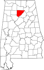 Map of Alabama highlighting Cullman County | |
| Towns | ||
| CDPs | ||
| Unincorporated communities | ||
| Footnotes | ‡This populated place also has portions in an adjacent county or counties | |