Baie-des-Chaloupes, Quebec
Baie-des-Chaloupes is an unorganized territory of Quebec located in the regional county municipality of Antoine-Labelle, in Laurentides, in Québec, in Canada.[2] It covers a land area of 900 km.
Baie-des-Chaloupes | |
|---|---|
Unorganized territory | |
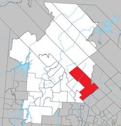 Location within Antoine-Labelle RCM. | |
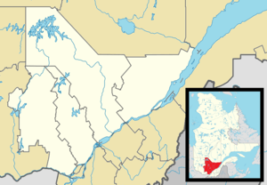 Baie-des-Chaloupes Location in central Quebec. | |
| Coordinates: 46°35′N 74°32′W[1] | |
| Country | |
| Province | |
| Region | Laurentides |
| RCM | Antoine-Labelle |
| Constituted | January 1, 1986 |
| Government | |
| • Federal riding | Laurentides—Labelle |
| • Prov. riding | Labelle |
| Area | |
| • Total | 954.50 km2 (368.53 sq mi) |
| • Land | 899.62 km2 (347.35 sq mi) |
| Population (2011)[3] y | |
| • Total | 0 |
| • Density | 0.0/km2 (0/sq mi) |
| • Pop 2006-2011 | |
| • Dwellings | 0 |
| Time zone | UTC−5 (EST) |
| • Summer (DST) | UTC−4 (EDT) |
| Highways | No major routes |
History
This unorganized territory was created on January 1, 1981 by the Government of Québec.[4]
Demographics
Population trend:[5]
- Population in 2011: 0
- Population in 2006: 0
- Population in 2001: 0
- Population in 1996: 0
- Population in 1991: 4
gollark: For example, imagine an HTML sanitization library for blogs or something which parses HTML differently to browsers.
gollark: *And* sometimes things interpret invalid things in different ways, which causes security issues.
gollark: And that means your thing has to keep including flaky backward compatibility hax to keep broken stuff working.
gollark: If you make bad behavior *work*, people will keep using it.
gollark: See, you might think "oh, but it's good if we support more stuff", but it's *not* really.
References
- Reference number 149722 of the Commission de toponymie du Québec (in French)
- "Répertoire des municipalités (in French)". Archived from the original on 2012-05-01. Retrieved 14 May 2011.
- Statistics Canada 2011 Census - Baie-des-Chaloupes profile
- "Commission de toponymie du Québec - Banque of places names - Baie-des-Chaloupes". Archived from the original on 2012-05-01. Retrieved 2011-05-14.
- Statistics Canada: 1996, 2001, 2006, 2011 census
Adjacent Municipal Subdivisions | |
|---|---|
| Cities/towns | |
|---|---|
| Municipalities |
|
| Villages | |
| Unorganized territories | |
| |
This article is issued from Wikipedia. The text is licensed under Creative Commons - Attribution - Sharealike. Additional terms may apply for the media files.