Břasy
Břasy (German: Bschas) is a municipality and village in the Rokycany District in the Plzeň Region of the Czech Republic. It has about 2,300 inhabitants. It is located 10 km north of Rokycany and 3 km southwest of Radnice, 458 m above sea-level.
Břasy | |
|---|---|
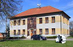
 Municipal office | |
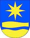
 Flag  Coat of arms | |
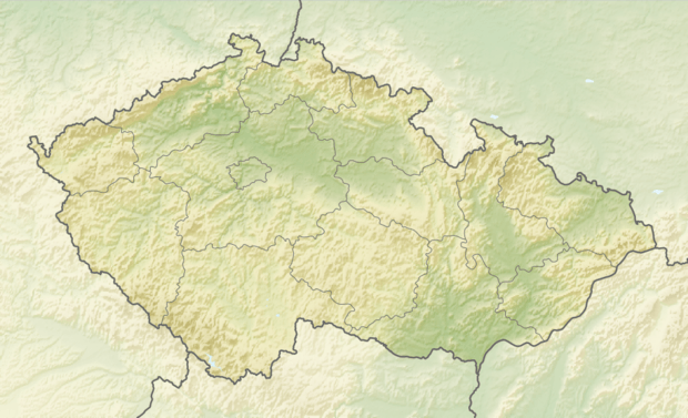
 Břasy Location in the Czech Republic | |
| Coordinates: 49°50′10″N 13°35′5″E | |
| Country | |
| Region | Plzeň |
| District | Rokycany |
| First mentioned | 1379 |
| Area | |
| • Total | 21.5 km2 (8.3 sq mi) |
| Elevation | 458 m (1,503 ft) |
| Population (2020-01-01[1]) | |
| • Total | 2,286 |
| • Density | 110/km2 (280/sq mi) |
| Time zone | UTC+1 (CET) |
| • Summer (DST) | UTC+2 (CEST) |
| Postal code | 338 24 |
| Website | www |
Geography
Břasy lies at largely deforested plateau, which falls sharply towards the valley of Berounka River in the west. Korečný potok Stream passes along the southern border of Břasy and Dírecký potok Stream along the northern periphery, both being only minor brooks that drain into Berounka River after several kilometers. The slopes along Berounka and both above-mentioned brooks are largely covered with forest, while central part of Břasy cadastre is largely forestless, except for scattered woods between the Břasy proper, Vranovice, Kříše and Stupno which replaced the abandoned coal mines and other industrial facilities. The II/232 from Rokycany passes through Břasy continuing to the north towards Liblín. The road II/233 that traverses the village connects Břasy with Chrást (Plzeň-město District) and Plzeň in the southwest and with Radnice to the northeast.
History
Břasy in its present shape is a result of massive industrial development of the region in the 2nd half of the 19th century and the 20th century. In the territory of what is today Břasy, several distinct villages were located until the 19th century, most of them decisively rural. These original components that predated modern time Břasy were Stupno, Kříše, Vranovice, Vranov and Darová.
Stupno was mentioned for the first time in 1146. The village's name evolved from Stúpa to Stupná, and finally to Stupno. Stupno grew into major village and served as a population center of the agglomeration for most of the 19th century. At the turn of the 20th century Stupno had population of 1,272.
Vranov (German: Wranow) was mentioned for the first time in 1379. The village located 1 km northeast of Stupno rapidly grew in the 19th century thanks to influx of workers into the coal mines. Worker's colony of Břasy arose here in the 19th century and Vranov was later renamed Břasy giving name to the unified community that stretches across the whole agglomeration. At the turn of the 20th century Vranov had population of 1,200.
Vranovice (German: Wranowitz) was mentioned for the first time in 1115. The village is situated 2 km northwest of Stupno. Unlike Stupno and Břasy it did not enter the contiguous built-up agglomeration but it also underwent rapid population growth as a result of industrial development. At the turn of the 20th century Vranovice had population of 750.
Kříše (German: Krisch) was mentioned for the first time in 1384. It is located 1,5 km northwest of Stupno. It also remains territorially distinct but the industrial development took place in the village proper and population growth occurred here too. With influx of workers the population reached more than 1,500 at the end of the 19th century.
Darová (German: Darowa) was mentioned for the first time in 1235. The village, 4 km northwest of Stupno is the most outlying part of Břasy. Located in the valley of the Berounka it never really lost its rural character despite some coal and iron ore mining. At the turn of the 20th century the village's population was 150. Hydroelectric plant was built on the Berounka river in the beginning of the 20th century.
Those rural settlements gradually amalgamated in the 19th and 20th centuries. The name of Břasy originally applied only to small workers' colony which was annexed by Vranov in 1918. In 1960 five villages were united under the municipality of Břasy. And in 1982 even Vranov proper was renamed Břasy.
The main impetus to industrial development was coal mining, area of Břasy became one of centers of Radnice coal basin. Local coal deposits were made available thanks to opening of Chrást-Stupno railway in 1863. In 1893 Stupno-Radnice stretch of the railway was added. Local network of railway sidings for coal transport evolved between Vranov and Stupno, from 1908 this siding was electrically powered. In 1953 it was abandoned, while the Chrást-Radnice railway operates until now. Mining activity resulted in population growth. Other industrial companies settled in Břasy too, such as glass plant in Vranov (until 1933, later converted to furniture factory, which closed in 1997), ceramics factory in Vranov, iron-foundry in Vranov, another ceramics factory later converted to chemical factory. In 1933 statue in memory of miners by leftist sculptor Emanuel Famíra was built in Vranov, only to be demolished by German authorities in 1941. In 1945 Břasy was liberated both by American and Soviet armies. Post-WWII development was also facilitated by Czechoslovak army's presence in Břasy (ground radar station, after 1989 abandoned). In 1969 coal mining in Břasy stopped.
Demography
As to ethnicity Břasy was traditionally a Czech settlement. However, with massive influx of workers a German-speaking community arose here. For example in 1890 the population of Kříše is reported to consist of 1,179 Czech-speaking and 364 German-speaking citizens. Combined population of all five villages forming modern time Břasy exceeded 5,000 at the turn of the 20th century and the agglomeration had semi-urban character. However, with depletion of coal mines the population began to fall and Břasy never reached formal urban status. As of 2007 the municipality has 2,088 inhabitants making it one of the larger municipalities in the Rokycany District.
|
|
| |||||||||||||||||||||||||||
| Source: [2][3] | |||||||||||||||||||||||||||||
Transport
The municipality is located on a train line leading from Ejpovice to Radnice. There is a train station which is served by regional trains.
References
External links
