Avon, Massachusetts
Avon is a town in Norfolk County, Massachusetts, United States. The population was 4,356 at the 2010 census.[1]
Avon, Massachusetts | |
|---|---|
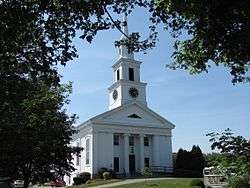
 Avon Baptist Church | |
 Seal | |
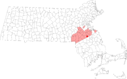
 Location in Norfolk County in Massachusetts | |
| Coordinates: 42°07′50″N 71°02′30″W | |
| Country | |
| State | |
| County | |
| Settled | 1700 |
| Incorporated | 1888 |
| Government | |
| • Type | Open town meeting |
| • Town Administrator | Gregory Enos |
| • Board of Selectmen | Eric S. Beckerman Steven P. Rose, Chair Jason Suzor |
| Area | |
| • Total | 11.8 km2 (4.6 sq mi) |
| • Land | 11.3 km2 (4.4 sq mi) |
| • Water | 0.5 km2 (0.2 sq mi) |
| Elevation | 67 m (219 ft) |
| Population (2010)[1] | |
| • Total | 4,356 |
| • Density | 385.5/km2 (990.0/sq mi) |
| Time zone | UTC−5 (Eastern) |
| • Summer (DST) | UTC−4 (Eastern) |
| ZIP Code | 02322 |
| Area code(s) | 508 / 774 |
| FIPS code | 25-02935 |
| GNIS feature ID | 0618314 |
| Website | www.avon-ma.gov |
History
Avon separated from Stoughton in 1888.
The first settler in Avon was Moses Curtis (c. 1720) a blacksmith from Braintree, Ma.
Avon's story begins deep in the forest of the Massachusetts Bay Colony, in the territory of the ancient town of Dorchester. In 1630 the Indian chief Chicataubut, in return for a sum of money, gave the English the right to settle Dorchester, south to the top of Blue Hill. After the chief's death, his brother Kitchamakin extended the boundary line farther southward, all the way to the Plymouth Colony line. This "New Grant" as it was called, gave the town of Dorchester title over 40,000 acres, making it the largest town in New England.
In 1726 Dorchester's South Precinct, holding the present-day towns of Stoughton, Avon, Sharon, Canton, and Foxborough, as well as parts of Wrenthham (Plainville) and Dedham, was set aside and incorporated under the name Stoughton. Its neighbor to the east, also resting on the Plymouth Colony line, was the town of Braintree, which at the time included present-day Quincy, Holbrook, and Randolph.
The road through the southeastern most corner of "Old Stoughton" was little more than a cart trail when Moses Curtis arrived from Braintree in 1720. Known simply as the "Old Beaten Path", it arched its back in a southwesterly direction after crossing the present-day Randolph line, and then gradually turned southeasterly as it approached the Bay Colony line, about two miles away. What attracted Curtis to this location is unknown, but it is fair to say that he had chosen one of the most isolated spots possible for settlement.
By 1720 only five houses preceded the Curtis homested in all of the present Stoughton-Avon area, and his stood virtually alone in the far southeastern corner of the "New Grant"...— A History of Avon, Massachusetts 1720–1988, by William F. Hanna[2]
Geography
According to the United States Census Bureau, the town has a total area of 4.6 square miles (12 km2), of which, 4.4 square miles (11 km2) of it is land and 0.2 square miles (0.52 km2) of it (4.16%) is water. Avon is bordered by the City of Brockton on the south, Stoughton on the west, Randolph on the northeast, and Holbrook on the east. Avon is 17 miles (27 km) south of Boston; 27 miles (43 km) northeast of Providence, Rhode Island; and 211 miles (340 km) from New York City.
Demographics
| Year | Pop. | ±% |
|---|---|---|
| 1890 | 1,384 | — |
| 1900 | 1,741 | +25.8% |
| 1910 | 2,013 | +15.6% |
| 1920 | 2,176 | +8.1% |
| 1930 | 2,414 | +10.9% |
| 1940 | 2,335 | −3.3% |
| 1950 | 2,666 | +14.2% |
| 1960 | 4,301 | +61.3% |
| 1970 | 5,295 | +23.1% |
| 1980 | 5,026 | −5.1% |
| 1990 | 4,558 | −9.3% |
| 2000 | 4,443 | −2.5% |
| 2010 | 4,356 | −2.0% |
| 2012 | 4,349 | −0.2% |
| * = population estimate. Source: United States Census records and Population Estimates Program data.[3][4][5][6][7][8][9] | ||
At the 2000 census,[10] there were 4,443 people, 1,705 households and 1,220 families residing in the town. The population density was 1,014.7 per square mile (391.7/km2). There were 1,740 housing units at an average density of 397.4 per square mile (153.4/km2). The racial makeup of the town was 93.45% White, 3.74% African American, 0.27% Native American, 0.92% Asian, 0.77% from other races, and 0.86% from two or more races. Hispanic or Latino of any race were 1.44% of the population. In 2010, Avon was 92.37% Non-Hispanic White, down from 99.8% in 1990.
There were 1,705 households of which 26.7% had children under the age of 18 living with them, 55.5% were married couples living together, 12.0% had a female householder with no husband present, and 28.4% were non-families. Of all households 23.5% were made up of individuals and 12.3% had someone living alone who was 65 years of age or older. The average household size was 2.61 and the average family size was 3.13.
Age distribution was 22.5% under the age of 18, 7.0% from 18 to 24, 28.8% from 25 to 44, 24.2% from 45 to 64, and 17.6% who were 65 years of age or older. The median age was 40 years. For every 100 females, there were 91.8 males. For every 100 females age 18 and over, there were 88.0 males.
The median household income was $50,305, and the median family income was $60,625. Males had a median income of $41,582 versus $32,837 for females. The per capita income for the town was $24,410. About 4.3% of families and 6.6% of the population were below the poverty line, including 12.5% of those under age 18 and 4.2% of those age 65 or over.
Government
Avon is governed by a three-person Board of Selectmen who appoint a Town Administrator to carry out the day to day executive functions of the Board. Legislation is enacted in an Open Town Meeting.
Education
The Avon School District serves Avon.
Transportation
The town is served by the Brockton Area Transit Authority and the Massachusetts Bay Transportation Authority (MBTA), which provide public transit service to Brockton and Boston.
References
- "Population and Housing Occupancy Status: 2010 - State -- County Subdivision, 2010 Census Redistricting Data (Public Law 94-171) Summary File". U.S. Census Bureau. Retrieved 2011-06-26.
- Hanna, William F. (1989). A History of Avon, Massachusetts 1720–1988. Avon, Mass.: The Avon Centennial Committee. OCLC 750986399.
- "TOTAL POPULATION (P1), 2010 Census Summary File 1, All County Subdivisions within Massachusetts". United States Census Bureau. Archived from the original on February 12, 2020. Retrieved September 13, 2011.
- "Massachusetts by Place and County Subdivision - GCT-T1. Population Estimates". United States Census Bureau. Archived from the original on January 6, 2012. Retrieved July 12, 2011.
- "1990 Census of Population, General Population Characteristics: Massachusetts" (PDF). US Census Bureau. December 1990. Table 76: General Characteristics of Persons, Households, and Families: 1990. 1990 CP-1-23. Archived from the original (PDF) on December 7, 2013. Retrieved July 12, 2011.
- "1980 Census of the Population, Number of Inhabitants: Massachusetts" (PDF). US Census Bureau. December 1981. Table 4. Populations of County Subdivisions: 1960 to 1980. PC80-1-A23. Archived from the original on August 5, 2010. Retrieved July 12, 2011.
- "1950 Census of Population" (PDF). 1: Number of Inhabitants. Bureau of the Census. 1952. Section 6, Pages 21-10 and 21-11, Massachusetts Table 6. Population of Counties by Minor Civil Divisions: 1930 to 1950. Retrieved July 12, 2011. Cite journal requires
|journal=(help) - "1920 Census of Population" (PDF). Bureau of the Census. Number of Inhabitants, by Counties and Minor Civil Divisions. Pages 21-5 through 21-7. Massachusetts Table 2. Population of Counties by Minor Civil Divisions: 1920, 1910, and 1920. Retrieved July 12, 2011.
- "1890 Census of the Population" (PDF). Department of the Interior, Census Office. Pages 179 through 182. Massachusetts Table 5. Population of States and Territories by Minor Civil Divisions: 1880 and 1890. Retrieved July 12, 2011.
- "U.S. Census website". United States Census Bureau. Retrieved 2008-01-31.
External links
| Wikimedia Commons has media related to Avon, Massachusetts. |
- Wicked Local Avon (published by GateHouse Media of Perinton, New York)
- Avon Municipal Web Site
- Answer Book/Avon: "Everything you need to know"
