Avigdor
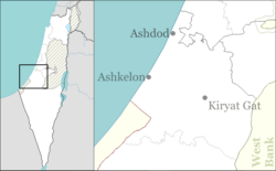
Avigdor (Hebrew: אֲבִיגְדוֹר) a small moshav in southern Israel. Located south of Kiryat Malakhi and 11 km north of Kiryat Gat and covering 3.75 km², it falls under the jurisdiction of Be'er Tuvia Regional Council. In 2018 its population was 820.[1]
Avigdor אֲבִיגְדוֹר | |
|---|---|
| Hebrew transcription(s) | |
| • official | Avigedor |
 Avigdor | |
 Avigdor  Avigdor | |
| Coordinates: 31°42′33.83″N 34°44′38.39″E | |
| Country | |
| District | Southern |
| Council | Be'er Tuvia |
| Affiliation | Moshavim Movement |
| Founded | 1950 |
| Founded by | Jewish British Army veterans |
| Population (2018) | 820[1] |
| Website | www.moshav-avigdor.com |
History
It was founded in 1950 by veterans of the British Army and was initially named Yael, the initials of Hebrew Units for Transportation, the unit that the veterans belonged to during the war. The commander of the unit was Henry d'Avigdor-Goldsmid, the son of Sir Osmond Elim d'Avigdor-Goldsmid. Later the name was changed and now it derives its name from the Zionist Sir Osmond Elim d'Avigdor-Goldsmid, an Englishman, president of the Palestine Jewish Colonization Association between the years 1934–1939 that donated to the moshav the municipality.[2] It was founded on the land belonging to the depopulated Palestinian village of Qastina.[3]
The population are partly agriculturist that their main occupation is dairy farming, turkeys and chicken and various field crops and partly free profession (lawyer, accountant, engineer, etc.) In the last years there is a development and building momentum.
References
- "Population in the Localities 2018" (XLS). Israel Central Bureau of Statistics. 25 August 2019. Retrieved 26 August 2019.
- Mapa's concise gazetteer of Israel (in Hebrew). Yuval Elʻazari (ed.). Tel-Aviv: Mapa Publishing. 2005. p. 14. ISBN 965-7184-34-7.CS1 maint: others (link)
- Khalidi, Walid (1992). All That Remains: The Palestinian Villages Occupied and Depopulated by Israel in 1948. Washington D.C.: Institute for Palestine Studies. p. 131. ISBN 0-88728-224-5. ISBN 0-88728-224-5.<
External links
- Village website (in Hebrew)