Auquihuato
Auquihuato[1][2] (possibly from Quechua, awki: prince, watu: prediction, fortuneteller)[3][4] is a cinder cone in the Andes of Peru, 4,980 metres (16,339 ft) high.[1] It is situated in the Ayacucho Region, Paucar del Sara Sara Province, on the border of the districts Colta and Oyolo.[5] Auquihuato lies northeast of Sara Sara volcano.[2]
| Auquihuato | |
|---|---|
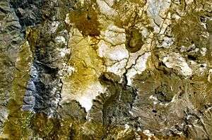 The cinder cone at the margin of the light-colored plateau just below the center of this NASA Landsat image (with north to the top) is Auquihuato. | |
| Highest point | |
| Elevation | 4,980 m (16,340 ft) |
| Coordinates | 15°04′30″S 73°11′26″W |
| Geography | |
 Auquihuato Peru | |
| Location | Peru, Ayacucho Region |
| Parent range | Andes |
| Geology | |
| Mountain type | Cinder cone |
Geology
Context
Auquihuato is surrounded by a Pliocene volcanic plateau,[6] the cone formed on the plateau's southern margin. Sara Sara lies 30 kilometres (19 mi) southwest[1] and Firura lies 10 kilometres (6.2 mi) farther east. Auquihuato lies east of the main volcanic arc and is aligned with several other volcanic centres in a northwest-southeast line.[7]
Activity
The noticeable lava flow is of Holocene age.[6]
Ground deformation has been observed by InSAR observation, centered 7 kilometres (4.3 mi) southeast of Auquihuato and with a circular shape. The ground deformation may be caused by changes in the pressure within the volcano's magma system, at depths probably exceeding 1 kilometre (0.62 mi).[6]
References
- "Cerro Auquihuato". Global Volcanism Program. Smithsonian Institution.
- Peru 1:100 000, Pausa (31-p). IGN (Instituto Geográfico Nacional - Perú).
- Teofilo Laime Ajacopa, Diccionario Bilingüe Iskay simipi yuyayk'ancha, La Paz, 2007 (Quechua-Spanish dictionary): awki. - s. Príncipe. Hijo de un ser superior o de un rey. watu. - s. Cordón. Cuerda delgada. watuq, wamuni, umu.. - s. Adivino. Persona que adivina. || fig. Hechicero, brujo. Layqa.
- Diccionario Quechua - Español - Quechua, Academía Mayor de la Lengua Quechua, Gobierno Regional Cusco, Cusco 2005: awki - s. Mit. En la mitología inkaica y la actual andina, man o espíritu protector, personaje mítico que habita en las altas cumbres, ser protector encamado en los montes, el alma de los cerros elevados. Generalmente se usa en plural: awkikuna, espíritus protectores. SINÓN: apucha, machula. || Príncipe, hijo del Inka. || Abuelo. watu - - s. Augurio, pronóstico, predicción, vaticinio, presagio. Ec: huatu. || Cordón, pita, cuerda, hilo retorcido. || Cinturón, correa.
- escale.minedu.gob.pe - UGEL Map of the Paucar del Sara Sara Province (Ayacucho Region)
- Morales Rivera, Anieri M.; Amelung, Falk; Mothes, Patricia (July 2016). "Volcano deformation survey over the Northern and Central Andes with ALOS InSAR time series". Geochemistry, Geophysics, Geosystems. 17 (7): 2869–2883. doi:10.1002/2016GC006393.
- de Silva, SL; Francis, PW (March 1990). "Potentially active volcanoes of Peru-Observations using Landsat Thematic Mapper and Space Shuttle imagery". Bulletin of Volcanology. 52 (4): 286–301. doi:10.1007/BF00304100.