Ashby, Suffolk
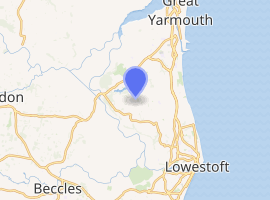
Ashby is a hamlet and former civil parish, now in the parish of Somerleyton, Ashby and Herringfleet, in the East Suffolk district, in the county of Suffolk, England, about 5 1⁄2 miles (9 km) northwest of Lowestoft. The hamlet is near the county boundary with Norfolk and about 5 1⁄2 miles (9 km) south-southwest of Great Yarmouth. In 1961 the parish had a population of 65.[1] In 1987 the parish was merged with Herringfleet and Somerleyton to form "Somerleyton, Ashby and Herringfleet".[2]
| Ashby | |
|---|---|
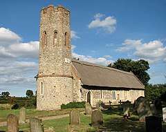
 St Mary's parish church seen from the southwest | |
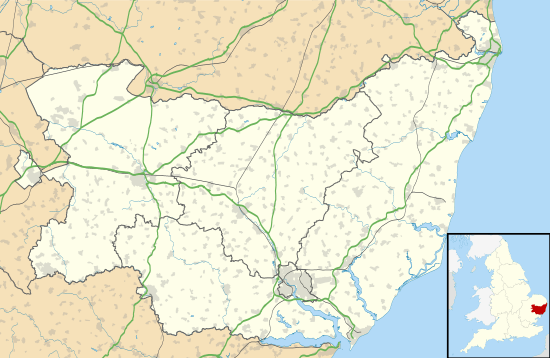
 Ashby Location within Suffolk | |
| OS grid reference | TM488996 |
| Civil parish | |
| District |
|
| Shire county | |
| Region | |
| Country | England |
| Sovereign state | United Kingdom |
| Post town | Lowestoft |
| Postcode district | NR32 |
| Dialling code | 01502 |
| Police | Suffolk |
| Fire | Suffolk |
| Ambulance | East of England |
| UK Parliament | |
| Website | ASH Villages |

| |
The Church of England parish church of St Mary is about 1⁄2 mile (800 m) south of the hamlet. The church is built of local flint, with a small amount of red brick for quoins and repairs. The roof of the nave and chancel is thatched.
The oldest part of the building is the Purbeck Marble Norman baptismal font, which is 12th- or 13th-century. The nave and chancel of the church are 13th-century. The church has an octagonal west tower that was rebuilt probably early in the 16th century. The church is a Grade I listed building.[3]
References
- "Population Statistics Ashby AP/CP through time". A Vision of Britain. Retrieved 25 January 2020.
- "The Waveney (Parishes) Order 1987" (PDF). Local Government Boundary Commission for England. Retrieved 25 January 2020.
- Historic England, "Church of St Mary (Grade I) (1352636)", National Heritage List for England, retrieved 19 October 2017
Further reading
- Pevsner, Nikolaus; Radcliffe, Enid (revision) (1974) [1961]. Suffolk. The Buildings of England. Harmondsworth: Penguin Books. p. 77. ISBN 0-14-071020-5.CS1 maint: ref=harv (link)