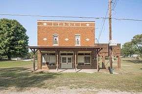
Arthur, Indiana
Arthur or Arthur Junction due to its location at the junction of Indiana 61 and Indiana 64, is an unincorporated community in Patoka Township, Pike County, in the U.S. state of Indiana.[2]
Arthur, Indiana | |
|---|---|
 | |
 Arthur  Arthur | |
| Coordinates: 38°20′26″N 87°14′45″W | |
| Country | United States |
| State | Indiana |
| County | Pike |
| Township | Patoka |
| Elevation | 489 ft (149 m) |
| Time zone | UTC-5 (Eastern (EST)) |
| • Summer (DST) | UTC-4 (EDT) |
| ZIP code | 47598 |
| Area code(s) | 812, 930 |
| GNIS feature ID | 430283 |
History
A post office was established at Arthur in 1873, and remained in operation until 1903.[3] The community was named for Arthur Thompson, an early settler.[4]
Geography
Arthur is located at 38°20′26″N 87°14′45″W.
gollark: Password policies are generally bad, they should be measuring entropy or something instead.
gollark: Oh. Hmm. That is more stupid than I thought.
gollark: Oh, or maybe mind control.
gollark: I'm guessing, since it says "laser pointer" and distances of some kind.
gollark: Is this something stupid about... pointing lasers at aeroplanes?
References
- "US Board on Geographic Names". United States Geological Survey. October 25, 2007. Retrieved 2016-11-17.
- "Arthur, Indiana". Geographic Names Information System. United States Geological Survey. Retrieved 2017-02-06.
- "Pike County". Jim Forte Postal History. Retrieved 5 October 2015.
- History of Pike and Dubois Counties, Indiana. Goodspeed Brothers. p. 428. ISBN 978-5-87521-222-2.
Municipalities and communities of Pike County, Indiana, United States | ||
|---|---|---|
| City | Map of Indiana highlighting Pike County | |
| Towns | ||
| Townships | ||
| CDP | ||
| Other unincorporated communities |
| |
| Footnotes | ‡This populated place also has portions in an adjacent county or counties | |
This article is issued from Wikipedia. The text is licensed under Creative Commons - Attribution - Sharealike. Additional terms may apply for the media files.