Armstrong, Ontario
Armstrong (2016 Population 1,166) is a township in the Timiskaming District of Ontario. The community of Earlton is part of Armstrong Township.
Armstrong | |
|---|---|
| Township of Armstrong | |
 Earlton | |
 Armstrong | |
| Coordinates: 47°42.5′N 79°49.5′W | |
| Country | Canada |
| Province | Ontario |
| District | Timiskaming |
| Government | |
| • Type | Township |
| • Mayor | Jean Marc Boileau |
| • Governing Body | Armstrong Township Council |
| • MP | Charlie Angus[1] |
| • MPP | John Vanthof[2] |
| Area | |
| • Land | 90.20 km2 (34.83 sq mi) |
| Population (2016)[3] | |
| • Total | 1,166 |
| • Density | 12.9/km2 (33/sq mi) |
| Time zone | UTC−05:00 (EST) |
| • Summer (DST) | UTC−04:00 (EDT) |
| Postal code | P0J 1E0 |
| Area code(s) | 705 (563 exchange) |
| Website | www |
The township is named after Samuel Armstrong, an Independent member of the Legislative Assembly of Ontario for Parry Sound from 1886 to 1890.
Leisure
- Earlton Community Centre and Arena
Economy
Major employers:
- Liquor Control Board of Ontario (LCBO)
- Desjardins Group
- Earlton Timber Mart[4]
The community is renowned for its dairy and cash crop farms.
Transportation
Earlton (Timiskaming Regional) Airport is a regional airport located in Earlton, which opened in 1937 as an emergency landing area for Trans-Canada Air Lines. The airport today serves private light aircraft. It was served by NorOntair from 1973 to 1996, and by the Air Defense Command in the 1950s.[5]
Ontario Highway 11 is the major road connecting the community with other areas in Timiskaming and beyond. The retail strip is located along 10th Street North.
See also
References
- "Voter Information Service". Elections Canada. Retrieved 2010-04-15.
- "MPP John Vanthof". Elections Ontario. Retrieved 2012-02-16.
- "Armstrong Census Profile". 2016 Census data. Statistics Canada. Retrieved 2012-02-16.
- "Earlton Timber Mart".
- "History". Earlton-Timiskaming Regional Airport. Retrieved July 19, 2019.
External links

- Township of Armstrong
Places adjacent to Armstrong, Ontario | |
|---|---|
| City | 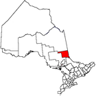 | |
|---|---|---|
| Towns | ||
| Townships | ||
| Village | ||
| Indian Reserves | ||
| Unorganized areas | ||
| Local services boards | ||
| ||