Arcahaie
Arcahaie (Haitian Creole: Lakayè) is a commune in the Arcahaie Arrondissement, in the Ouest department of Haiti. In 2015, the commune had 130,306 inhabitants.
Arcahaie
| |
|---|---|
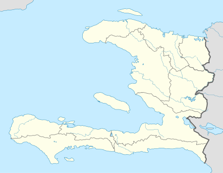
 Arcahaie Location in Haiti | |
| Coordinates: 18°46′0″N 72°31′0″W | |
| Country | Haiti |
| Department | Ouest |
| Arrondissement | Arcahaie |
| Area | |
| • Total | 408.73 km2 (157.81 sq mi) |
| Elevation | 16 m (52 ft) |
| Population (March, 2015)[2] | |
| • Total | 130,306 |
| • Density | 319/km2 (830/sq mi) |
Settlements
- André
- Arcahaie
- Ca Pierre
- Corridor Gangny
- Couya
- Dasse
- Délice
- Douphine
- Giulbert
- Grande Place
- Grois Morne
- Justin
- Marotte
- Merotte
- Mitan
- Passe
- Petit Bois
- Saintard
- Saint Medard
- Ti Couloute
- Thomas Sourigol, Arcahaie, Ouest (Thomas)
gollark: Surely nobody is going around licking windows *now*.
gollark: · · ·
gollark: There *is* a difference between useful criticism and people just telling you you're terrible somehow.
gollark: is the definite article.
gollark: I have somewhat wondered if I have that, since I can't focus very well on things, context-switch between tasks a lot, and procrastinate heavily.
References
- - Elevation Map - Arcahaie, Haiti
- "Mars 2015 Population Totale, Population de 18 ans et Plus Menages et Densites Estimes en 2015" (PDF). Institut Haïtien de Statistique et d’Informatique (IHSI). Archived from the original (PDF) on 6 November 2015. Retrieved 3 June 2017.
This article is issued from Wikipedia. The text is licensed under Creative Commons - Attribution - Sharealike. Additional terms may apply for the media files.
