Arabi, Georgia
Arabi (Arabic: أرابي) is a town in Crisp County, Georgia, United States. As of the 2010 census, it had a population of 586.[5]
Arabi, Georgia | |
|---|---|
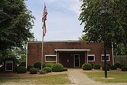
 Arabi City Hall | |
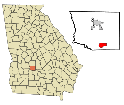
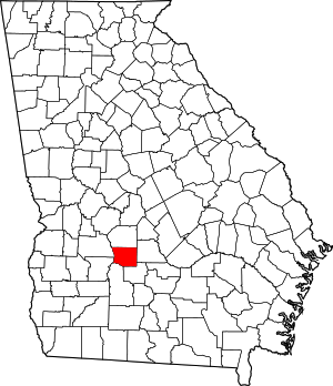
 Location in Crisp County and the state of Georgia | |
| Coordinates: 31°50′1″N 83°44′6″W | |
| Country | United States |
| State | Georgia |
| County | Crisp |
| Area | |
| • Total | 6.44 sq mi (16.69 km2) |
| • Land | 6.29 sq mi (16.30 km2) |
| • Water | 0.15 sq mi (0.38 km2) |
| Elevation | 440 ft (134 m) |
| Population (2010) | |
| • Total | 586 |
| • Estimate (2019)[2] | 564 |
| • Density | 89.59/sq mi (34.59/km2) |
| Time zone | UTC-5 (Eastern (EST)) |
| • Summer (DST) | UTC-4 (EDT) |
| ZIP code | 31712 |
| Area code(s) | 229 |
| FIPS code | 13-02564[3] |
| GNIS feature ID | 0331047[4] |
| Website | cityofarabi |
History
The first permanent settlement at Arabi was made in 1888.[6] According to tradition, the name "Arabi" was coined after a local surname.[6] The town was chartered in 1891.[7]
Geography
Arabi is located in southern Crisp County at 31°50′1″N 83°44′6″W (31.833473, -83.734912).[8] U.S. Route 41 passes through the center of the town as Bedgood Avenue, leading north 9 miles (14 km) to Cordele, the county seat, and south 10 miles (16 km) to Ashburn. Interstate 75 passes through the eastern side of the town, with access from Exit 92, and leads north 73 miles (117 km) to Macon and south 75 miles (121 km) to Valdosta.
According to the United States Census Bureau, Arabi has a total area of 6.4 square miles (16.6 km2), of which 6.3 square miles (16.3 km2) is land and 0.12 square miles (0.3 km2), or 1.81%, is water.[9]
Demographics
| Historical population | |||
|---|---|---|---|
| Census | Pop. | %± | |
| 1900 | 505 | — | |
| 1910 | 433 | −14.3% | |
| 1920 | 532 | 22.9% | |
| 1930 | 452 | −15.0% | |
| 1940 | 388 | −14.2% | |
| 1950 | 376 | −3.1% | |
| 1960 | 303 | −19.4% | |
| 1970 | 305 | 0.7% | |
| 1980 | 376 | 23.3% | |
| 1990 | 433 | 15.2% | |
| 2000 | 456 | 5.3% | |
| 2010 | 586 | 28.5% | |
| Est. 2019 | 564 | [2] | −3.8% |
| U.S. Decennial Census[10] | |||
As of the census[3] of 2000, there were 456 people, 185 households, and 120 families residing in the town. The population density was 100.9 people per square mile (39.0/km2). There were 204 housing units at an average density of 45.1 per square mile (17.4/km2). The racial makeup of the town was 74.78% White, 24.34% African American and 0.88% Asian.
There were 185 households, out of which 29.7% had children under the age of 18 living with them, 52.4% were married couples living together, 10.3% had a female householder with no husband present, and 34.6% were non-families. 32.4% of all households were made up of individuals, and 15.1% had someone living alone who was 65 years of age or older. The average household size was 2.46 and the average family size was 3.09.
In the town, the population was spread out, with 24.8% under the age of 18, 8.6% from 18 to 24, 28.3% from 25 to 44, 23.7% from 45 to 64, and 14.7% who were 65 years of age or older. The median age was 38 years. For every 100 females, there were 103.6 males. For every 100 females age 18 and over, there were 100.6 males.
The median income for a household in the town was $24,327, and the median income for a family was $26,750. Males had a median income of $27,321 versus $13,281 for females. The per capita income for the town was $11,157. About 13.1% of families and 19.9% of the population were below the poverty line, including 26.4% of those under age 18 and 20.0% of those age 65 or over.
Notable person
- T. Graham Brown, country music singer
References
- "2019 U.S. Gazetteer Files". United States Census Bureau. Retrieved July 9, 2020.
- "Population and Housing Unit Estimates". United States Census Bureau. May 24, 2020. Retrieved May 27, 2020.
- "U.S. Census website". United States Census Bureau. Retrieved 2008-01-31.
- "US Board on Geographic Names". United States Geological Survey. 2007-10-25. Retrieved 2008-01-31.
- United States Census
- Krakow, Kenneth K. (1975). Georgia Place-Names: Their History and Origins (PDF). Macon, GA: Winship Press. p. 6. ISBN 0-915430-00-2.
- "Arabi". New Georgia Encyclopedia. Retrieved 31 March 2018.
- "US Gazetteer files: 2010, 2000, and 1990". United States Census Bureau. 2011-02-12. Retrieved 2011-04-23.
- "Geographic Identifiers: 2010 Demographic Profile Data (G001): Arabi town, Georgia". U.S. Census Bureau, American Factfinder. Archived from the original on February 12, 2020. Retrieved July 31, 2014.
- "Census of Population and Housing". Census.gov. Retrieved June 4, 2015.
